Approximate Location Map
Large Map »
Latitude: 51.6374 / 51°38'14"N
Longitude: -1.8598 / 1°51'35"W
OS Eastings: 409799
OS Northings: 193191
OS Grid: SU097931
Mapcode National: GBR 3S1.BM6
Mapcode Global: VHB35.Q35K
Plus Code: 9C3WJ4PR+X3
Entry Name: Orthostatic Wall to the Chimneys
Listing Date: 26 August 1976
Last Amended: 17 April 1986
Grade: II
Source: Historic England
Source ID: 1023093
English Heritage Legacy ID: 317760
ID on this website: 101023093
Location: Cricklade, Wiltshire, SN6
County: Wiltshire
Civil Parish: Cricklade
Built-Up Area: Cricklade
Traditional County: Wiltshire
Lieutenancy Area (Ceremonial County): Wiltshire
Church of England Parish: Cricklade
Church of England Diocese: Bristol
Tagged with: Wall
SU 09 SE CRICKLADE THE FORTY
(south side)
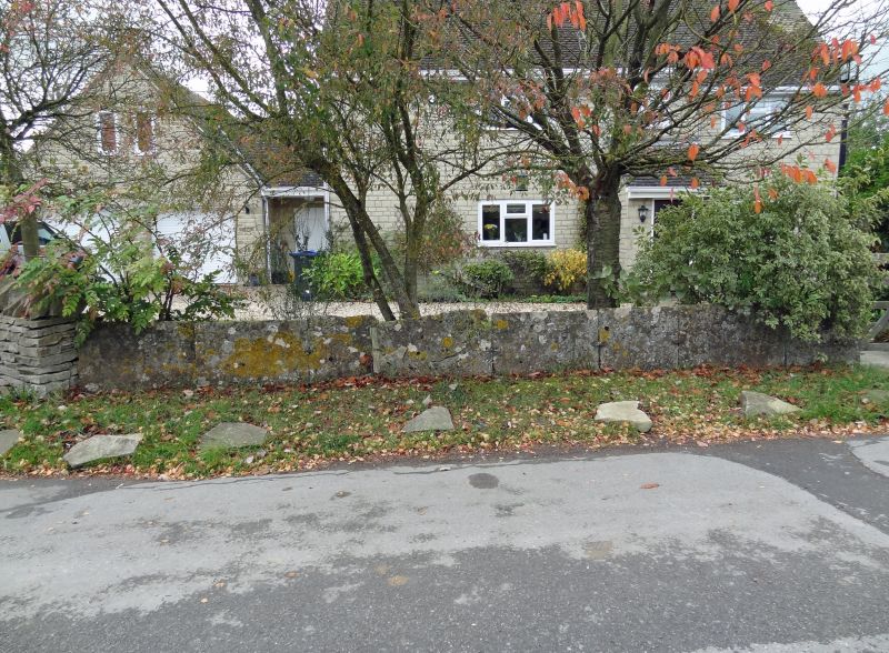
12/111 Orthostatic wall to The Chimneys
(formerly listed as Flagstone wall
to east of No 14)
11.11.76
II
Orthostatic limestone wall, early-mid C19. Bounding front garden
of property against road. Approximately 24 stones forming wall
about 1m high.
Listing NGR: SU0979993191
External links are from the relevant listing authority and, where applicable, Wikidata. Wikidata IDs may be related buildings as well as this specific building. If you want to add or update a link, you will need to do so by editing the Wikidata entry.


Other nearby listed buildings
