Approximate Location Map
Large Map »
Latitude: 51.641 / 51°38'27"N
Longitude: -1.8563 / 1°51'22"W
OS Eastings: 410041
OS Northings: 193584
OS Grid: SU100935
Mapcode National: GBR 3S1.5HR
Mapcode Global: VHB35.S00V
Plus Code: 9C3WJ4RV+9F
Entry Name: 108, High Street
Listing Date: 17 January 1955
Grade: II
Source: Historic England
Source ID: 1023122
English Heritage Legacy ID: 317829
ID on this website: 101023122
Location: Cricklade, Wiltshire, SN6
County: Wiltshire
Civil Parish: Cricklade
Built-Up Area: Cricklade
Traditional County: Wiltshire
Lieutenancy Area (Ceremonial County): Wiltshire
Church of England Parish: Cricklade
Church of England Diocese: Bristol
Tagged with: Building
SU 19 SW CRICKLADE HIGH STREET
(east side)
13/179 No. 108
17.1.55
GV II
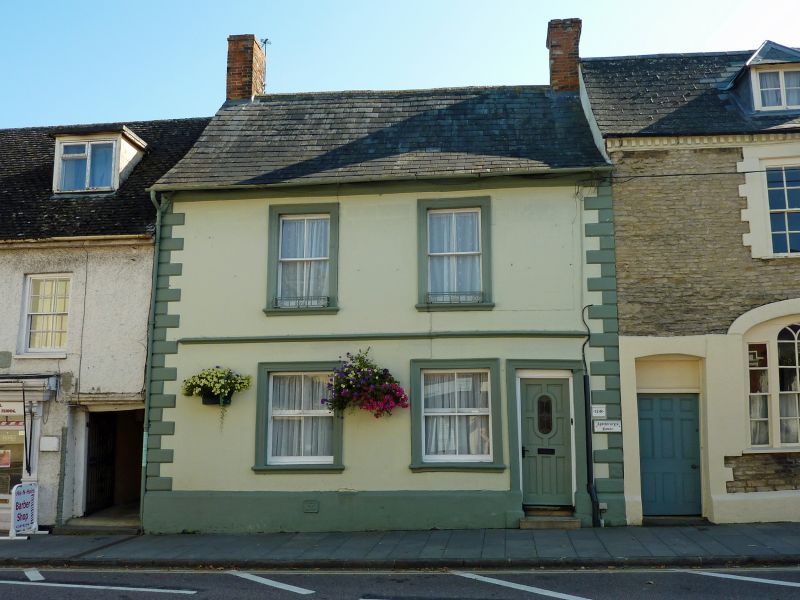
House, rendered with raised quoins. Welsh slate roof. Two
storeys, 2 bays. C20 door on right. Four-pane sashes within
moulded architraves and mid-wall string. Brick stacks to gables.
Listing NGR: SU1004193584
External links are from the relevant listing authority and, where applicable, Wikidata. Wikidata IDs may be related buildings as well as this specific building. If you want to add or update a link, you will need to do so by editing the Wikidata entry.


Other nearby listed buildings
