Approximate Location Map
Large Map »
Latitude: 50.9221 / 50°55'19"N
Longitude: -0.1322 / 0°7'56"W
OS Eastings: 531374
OS Northings: 115292
OS Grid: TQ313152
Mapcode National: GBR JMZ.3DP
Mapcode Global: FRA B6MN.SCT
Plus Code: 9C2XWVC9+V4
Entry Name: The Old Manor House
Listing Date: 11 May 1983
Grade: II
Source: Historic England
Source ID: 1025650
English Heritage Legacy ID: 302663
ID on this website: 101025650
Location: Keymer, Mid Sussex, BN6
County: West Sussex
District: Mid Sussex
Civil Parish: Hassocks
Built-Up Area: Hurstpierpoint
Traditional County: Sussex
Lieutenancy Area (Ceremonial County): West Sussex
Church of England Parish: Clayton with Keymer
Church of England Diocese: Chichester
Tagged with: House
KEYMER KEYMER ROAD
1.
5405
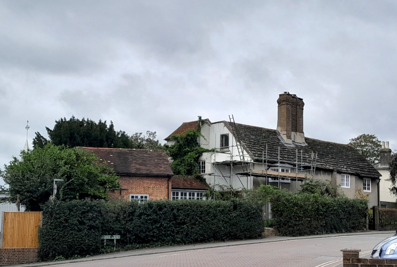
Nos 102 and 104 (The Old
Manor House)
TQ 31 NW 20/49
II
2.
One building now subdivided, C15 timber-framer aisled hall now faced with cement.
Horsham slab roof. Red brick chimney stack. Small bay on both floors at south end.
Modern porch. Two storeys. Three windows.
Listing NGR: TQ3137415292
External links are from the relevant listing authority and, where applicable, Wikidata. Wikidata IDs may be related buildings as well as this specific building. If you want to add or update a link, you will need to do so by editing the Wikidata entry.


Other nearby listed buildings
