Approximate Location Map
Large Map »
Latitude: 50.8673 / 50°52'2"N
Longitude: -0.7757 / 0°46'32"W
OS Eastings: 486249
OS Northings: 108243
OS Grid: SU862082
Mapcode National: GBR DGD.GPR
Mapcode Global: FRA 968T.1MB
Plus Code: 9C2XV68F+WP
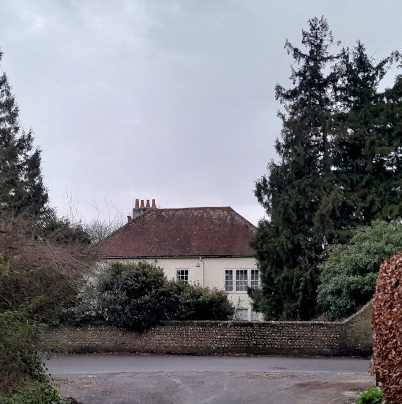
Entry Name: Church Farmhouse
Listing Date: 5 June 1958
Grade: II
Source: Historic England
Source ID: 1026300
English Heritage Legacy ID: 300954
ID on this website: 101026300
Location: East Lavant, Chichester, West Sussex, PO18
County: West Sussex
District: Chichester
Civil Parish: Lavant
Traditional County: Sussex
Lieutenancy Area (Ceremonial County): West Sussex
Church of England Parish: Lavant St Mary
Church of England Diocese: Chichester
Tagged with: Farmhouse
LAVANT FORDWATER ROAD
SU 8608-8708 EAST LAVANT
37/328 Church Farmhouse
5.6.58
- II
C18 exterior to a probably older building. Two storeys. Three windows.
Painted brick. Modillion eaves cornice. Steeply-pitched hipped tiled roof.
Glazing bars intact. Porch with Doric columns and triglyph frieze. Doorway
with segmental fanlight and door of six fielded panels.
Listing NGR: SU8624908243
External links are from the relevant listing authority and, where applicable, Wikidata. Wikidata IDs may be related buildings as well as this specific building. If you want to add or update a link, you will need to do so by editing the Wikidata entry.


Other nearby listed buildings
