Approximate Location Map
Large Map »
Latitude: 50.8656 / 50°51'56"N
Longitude: -0.7104 / 0°42'37"W
OS Eastings: 490848
OS Northings: 108134
OS Grid: SU908081
Mapcode National: GBR DGH.M6Z
Mapcode Global: FRA 96DT.91F
Plus Code: 9C2XV78Q+6R
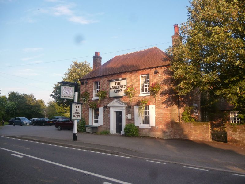
Entry Name: The Anglesey Inn
Listing Date: 28 January 1986
Grade: II
Source: Historic England
Source ID: 1026410
English Heritage Legacy ID: 300709
ID on this website: 101026410
Location: Halnaker, Chichester, West Sussex, PO18
County: West Sussex
District: Chichester
Civil Parish: Boxgrove
Traditional County: Sussex
Lieutenancy Area (Ceremonial County): West Sussex
Church of England Parish: Boxgrove
Church of England Diocese: Chichester
Tagged with: Inn
BOXGROVE PETWORTH ROAD, (south east side)
SU 90 NW HALNAKER
14/64 The Anglesey Inn
-
- II
Early C19 (? 1815). Two storeys. Two windows. Red brick and grey headers
alternately. Modillion eaves cornice. Tiled roof. Glazing bars intact.
Stuccoed doorway with pilasters and pediment.
Listing NGR: SU9084808134
External links are from the relevant listing authority and, where applicable, Wikidata. Wikidata IDs may be related buildings as well as this specific building. If you want to add or update a link, you will need to do so by editing the Wikidata entry.


Other nearby listed buildings
