Approximate Location Map
Large Map »
Latitude: 50.8372 / 50°50'13"N
Longitude: -0.7786 / 0°46'42"W
OS Eastings: 486101
OS Northings: 104891
OS Grid: SU861048
Mapcode National: GBR DGS.FYW
Mapcode Global: FRA 968W.DHX
Plus Code: 9C2XR6PC+VH
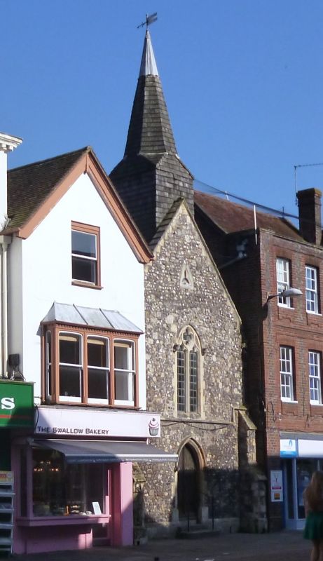
Entry Name: The Former Church of St Olave
Listing Date: 8 October 1971
Grade: I
Source: Historic England
Source ID: 1026724
English Heritage Legacy ID: 300042
ID on this website: 101026724
Location: Chichester, West Sussex, PO19
County: West Sussex
District: Chichester
Civil Parish: Chichester
Built-Up Area: Chichester
Traditional County: Sussex
Lieutenancy Area (Ceremonial County): West Sussex
Church of England Parish: Chichester St Paul
Church of England Diocese: Chichester
Tagged with: Former church
NORTH STREET
1.
972
(East Side)
The former Church
of St Olave
SU 8604 NW 4/47
I GV
2.
Nave C11. Chancel C13.
Nos 74 to 81 (consec) including No 75A and former St Olave's Church form a
group.
Listing NGR: SU8609804891
External links are from the relevant listing authority and, where applicable, Wikidata. Wikidata IDs may be related buildings as well as this specific building. If you want to add or update a link, you will need to do so by editing the Wikidata entry.


Other nearby listed buildings
