Approximate Location Map
Large Map »
Latitude: 50.8709 / 50°52'15"N
Longitude: -0.5212 / 0°31'16"W
OS Eastings: 504150
OS Northings: 108978
OS Grid: TQ041089
Mapcode National: GBR GKD.71S
Mapcode Global: FRA 96SS.YK3
Plus Code: 9C2XVFCH+9G
Entry Name: 88 and 89, the Street
Listing Date: 27 October 1976
Last Amended: 20 September 1984
Grade: II
Source: Historic England
Source ID: 1027661
English Heritage Legacy ID: 297793
ID on this website: 101027661
Location: Burpham, Arun, West Sussex, BN18
County: West Sussex
District: Arun
Civil Parish: Burpham
Traditional County: Sussex
Lieutenancy Area (Ceremonial County): West Sussex
Church of England Parish: Burpham St Mary the Virgin
Church of England Diocese: Chichester
Tagged with: Building Thatched building
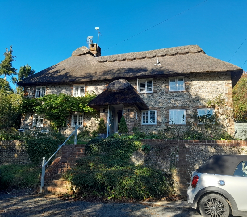
TQ 0408 BURPHAM THE STREET
29/221
27.10.76
Nos 88 and 89
(formerly listed under
Burpham Street)
II
One building. C18. Two storeys. Four windows. Faced with flints with red brick
dressings and quoins. Hipped thatched roof. Casement windows.
Listing NGR: TQ0415008978
External links are from the relevant listing authority and, where applicable, Wikidata. Wikidata IDs may be related buildings as well as this specific building. If you want to add or update a link, you will need to do so by editing the Wikidata entry.


Other nearby listed buildings
