Approximate Location Map
Large Map »
Latitude: 50.8405 / 50°50'25"N
Longitude: -0.6855 / 0°41'7"W
OS Eastings: 492653
OS Northings: 105378
OS Grid: SU926053
Mapcode National: GBR FJ7.7JM
Mapcode Global: FRA 96GW.6S8
Plus Code: 9C2XR8R7+6R
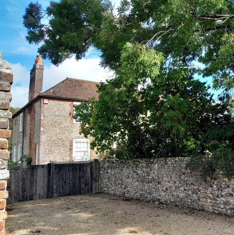
Entry Name: The Square House
Listing Date: 20 September 1976
Grade: II
Source: Historic England
Source ID: 1027739
English Heritage Legacy ID: 297669
ID on this website: 101027739
Location: Aldingbourne, Arun, West Sussex, PO20
County: West Sussex
District: Arun
Civil Parish: Aldingbourne
Traditional County: Sussex
Lieutenancy Area (Ceremonial County): West Sussex
Church of England Parish: Aldingbourne, Barnham and Eastergate
Church of England Diocese: Chichester
Tagged with: House
SU 90 NW ALDINGBOURNE HOOK LANE
7/443
The Square House
20.9.76
II
Late C18. Two storeys. Three windows. Faced with flints with red brick dressings and
quoins. Tiled roof. Glazing bars intact. Doorway with pilasters and pediment.
Listing NGR: SU9265305378
External links are from the relevant listing authority and, where applicable, Wikidata. Wikidata IDs may be related buildings as well as this specific building. If you want to add or update a link, you will need to do so by editing the Wikidata entry.


Other nearby listed buildings
