Approximate Location Map
Large Map »
Latitude: 51.0109 / 51°0'39"N
Longitude: 0.4739 / 0°28'25"E
OS Eastings: 573639
OS Northings: 126416
OS Grid: TQ736264
Mapcode National: GBR PV8.DNN
Mapcode Global: FRA C6WF.VV7
Plus Code: 9F322F6F+9G
Entry Name: Grove Hill Farmhouse
Listing Date: 13 May 1987
Grade: II
Source: Historic England
Source ID: 1034441
English Heritage Legacy ID: 409819
ID on this website: 101034441
Location: Silver Hill, Rother, East Sussex, TN19
County: East Sussex
District: Rother
Civil Parish: Hurst Green
Traditional County: Sussex
Lieutenancy Area (Ceremonial County): East Sussex
Church of England Parish: Salehurst St Mary
Church of England Diocese: Chichester
Tagged with: Farmhouse
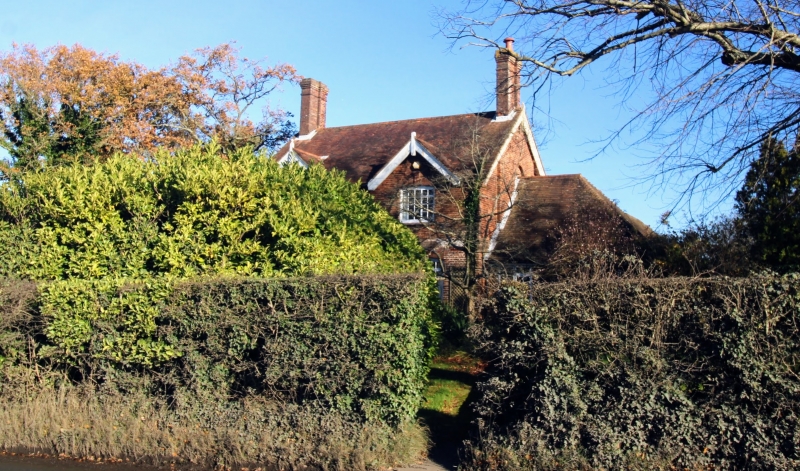
TQ 72 NW HURST GREEN LONDON ROAD
(east side)
5/7 Grove Hill Farmhouse
II
C18. Two storeys. Three windows. Ground floor red brick, above tile-hung.
Tiled roof. Glazing bars- intact. Later glazed and gabled porch.
Listing NGR: TQ7363926416
External links are from the relevant listing authority and, where applicable, Wikidata. Wikidata IDs may be related buildings as well as this specific building. If you want to add or update a link, you will need to do so by editing the Wikidata entry.


Other nearby listed buildings
