Approximate Location Map
Large Map »
Latitude: 53.367 / 53°22'1"N
Longitude: -1.9832 / 1°58'59"W
OS Eastings: 401217
OS Northings: 385572
OS Grid: SK012855
Mapcode National: GBR GYLH.GQ
Mapcode Global: WHBB5.HMVM
Plus Code: 9C5W9288+RP
Entry Name: Farm Buildings to Ollersett Hall Farm
Listing Date: 19 September 1977
Grade: II
Source: Historic England
Source ID: 1039893
English Heritage Legacy ID: 81843
ID on this website: 101039893
Location: Low Leighton, High Peak, Derbyshire, SK22
County: Derbyshire
District: High Peak
Civil Parish: New Mills
Traditional County: Derbyshire
Lieutenancy Area (Ceremonial County): Derbyshire
Church of England Parish: New Mills St George
Church of England Diocese: Derby
Tagged with: Agricultural structure
NEW MILLS LANESIDE ROAD
1.
5172
(North Side)
Farm buildings to
SK 08 NW 4/76A Ollersett Hall Farm
II GV
2.
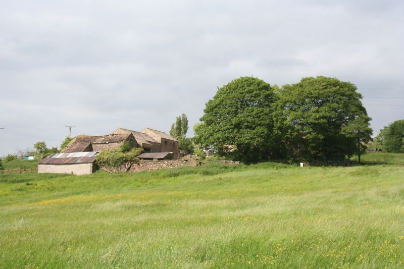
C17 or early C18 farm buildings of 2-storey height in coursed stone with stone
slate roofs. Similar in style and materials to the farmhouse with which the block
of buildings forms a visual group.
Listing NGR: SK0121785572
External links are from the relevant listing authority and, where applicable, Wikidata. Wikidata IDs may be related buildings as well as this specific building. If you want to add or update a link, you will need to do so by editing the Wikidata entry.


Other nearby listed buildings
