Approximate Location Map
Large Map »
Latitude: 52.6202 / 52°37'12"N
Longitude: -2.453 / 2°27'10"W
OS Eastings: 369428
OS Northings: 302583
OS Grid: SJ694025
Mapcode National: GBR BX.84T9
Mapcode Global: WH9DH.9D4N
Plus Code: 9C4VJGCW+3Q
Entry Name: 17, Coalport High Street
Listing Date: 22 January 1975
Grade: II
Source: Historic England
Source ID: 1054162
English Heritage Legacy ID: 362006
ID on this website: 101054162
Location: Coalport, Telford and Wrekin, Shropshire, TF8
County: Telford and Wrekin
Civil Parish: The Gorge
Traditional County: Shropshire
Lieutenancy Area (Ceremonial County): Shropshire
Church of England Parish: Madeley
Church of England Diocese: Hereford
Tagged with: Building
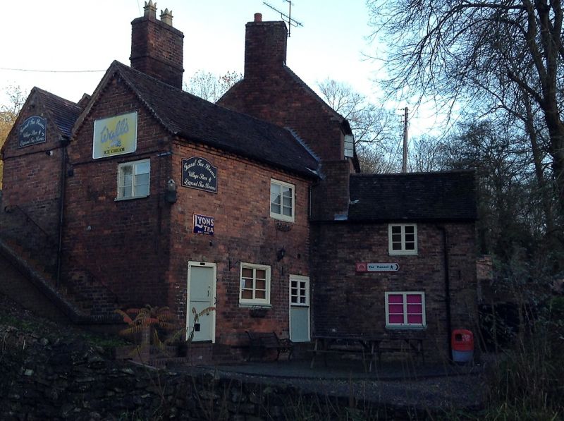
COALPORT COALPORT HIGH STREET
1.
5362 No 17
SJ 6902 17/142 22.1.75
II GV
2.
Early/mid C19 red brick house. Tiled roof with gabled ends and brick dentil eaves
course. Back to road 2 storeys; south front 3 storeys, 2 windows, casements, left-
hand first floor sash, ground floor segmental-headed doorway to Tar Tunnel. Two
storey wing to west.
Listing NGR: SJ6942802583
External links are from the relevant listing authority and, where applicable, Wikidata. Wikidata IDs may be related buildings as well as this specific building. If you want to add or update a link, you will need to do so by editing the Wikidata entry.


Other nearby listed buildings
