Approximate Location Map
Large Map »
Latitude: 51.2276 / 51°13'39"N
Longitude: 1.4027 / 1°24'9"E
OS Eastings: 637672
OS Northings: 153099
OS Grid: TR376530
Mapcode National: GBR X1R.TR1
Mapcode Global: VHMDG.8DFT
Plus Code: 9F336CH3+23
Entry Name: 3, New Street
Listing Date: 8 February 1974
Grade: II
Source: Historic England
Source ID: 1069778
English Heritage Legacy ID: 177223
ID on this website: 101069778
Location: Deal, Dover, Kent, CT14
County: Kent
District: Dover
Civil Parish: Deal
Built-Up Area: Deal
Traditional County: Kent
Lieutenancy Area (Ceremonial County): Kent
Tagged with: Building
1.
1035
TR 3753 SE
2/430
NEW STREET
(North Side)
No 3
II
GV
2.
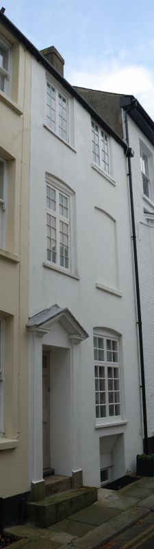
C19 front. 3 storeys and basement stuccoed. 2 altered windows. Left side doorcase
with open pediment and plain pilasters. 6 panelled door, the top 2 panels cut
away and glazed. 2 steps to street.
Nos 2, 3, 5, 6 and 6A form a group.
Listing NGR: TR3767253099
External links are from the relevant listing authority and, where applicable, Wikidata. Wikidata IDs may be related buildings as well as this specific building. If you want to add or update a link, you will need to do so by editing the Wikidata entry.


Other nearby listed buildings
