Approximate Location Map
Large Map »
Latitude: 51.226 / 51°13'33"N
Longitude: 1.4032 / 1°24'11"E
OS Eastings: 637711
OS Northings: 152929
OS Grid: TR377529
Mapcode National: GBR X1Y.1KY
Mapcode Global: VHMDG.8FNZ
Plus Code: 9F336CG3+C7
Entry Name: 83, Middle Street
Listing Date: 8 February 1974
Grade: II
Source: Historic England
Source ID: 1069785
English Heritage Legacy ID: 177151
ID on this website: 101069785
Location: Deal, Dover, Kent, CT14
County: Kent
District: Dover
Civil Parish: Deal
Built-Up Area: Deal
Traditional County: Kent
Lieutenancy Area (Ceremonial County): Kent
Tagged with: Building
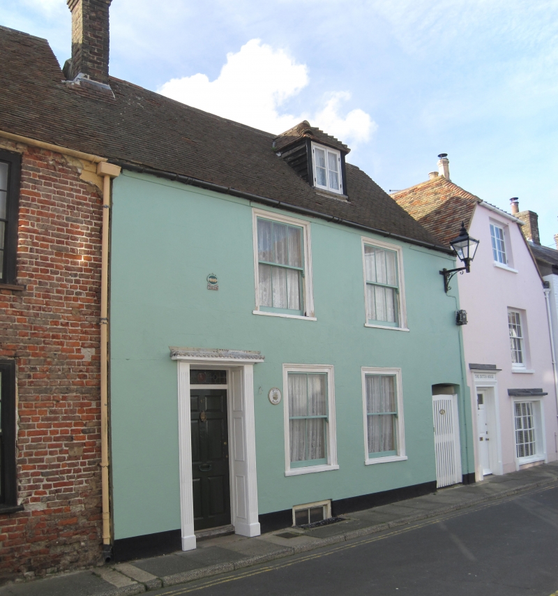
MIDDLE STREET
1.
1035
(West Side)
No 83
TR 5752 NE 1/315
II GV
2.
Mid C19. 2 storeys stuccoed. Tiled roof with 1 hipped dormer. 2 sashes with
verticals only and simple doorcases.
Nos 8l to 101 (odd) form a group.
Listing NGR: TR3771152929
External links are from the relevant listing authority and, where applicable, Wikidata. Wikidata IDs may be related buildings as well as this specific building. If you want to add or update a link, you will need to do so by editing the Wikidata entry.


Other nearby listed buildings
