Approximate Location Map
Large Map »
Latitude: 51.2267 / 51°13'36"N
Longitude: 1.4037 / 1°24'13"E
OS Eastings: 637745
OS Northings: 153005
OS Grid: TR377530
Mapcode National: GBR X1Y.1Q2
Mapcode Global: VHMDG.8FYG
Plus Code: 9F336CG3+MF
Entry Name: 5 and 6, Coppin Street
Listing Date: 8 February 1974
Grade: II
Source: Historic England
Source ID: 1069866
English Heritage Legacy ID: 177035
ID on this website: 101069866
Location: Deal, Dover, Kent, CT14
County: Kent
District: Dover
Civil Parish: Deal
Built-Up Area: Deal
Traditional County: Kent
Lieutenancy Area (Ceremonial County): Kent
Tagged with: Building
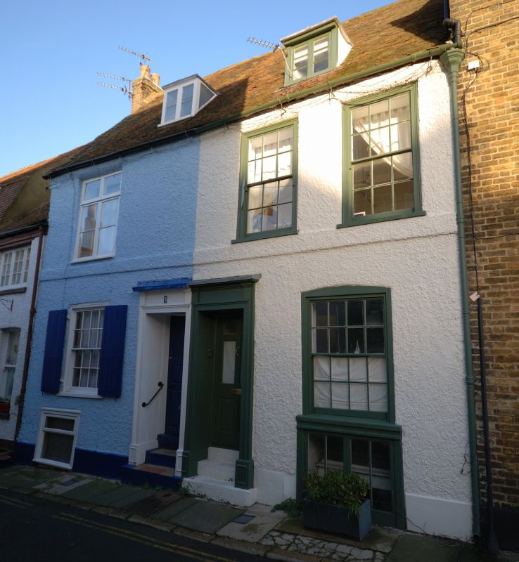
COPPIN STREET
1.
1035
(North Side)
Nos 5 and 6
TR 3752 NE 1/70
TR 3753 SE 2/70
II GV
2.
Mid to late C18. 2 storeys, basement and attics pebble dashed. Old tiled roof
with 2 dormers. 3 sashes with most glazing bars intact. Double doorcase with
cornices and pilasters.
Nos 1 to l0 (consec) form a group.
Listing NGR: TR3774553005
External links are from the relevant listing authority and, where applicable, Wikidata. Wikidata IDs may be related buildings as well as this specific building. If you want to add or update a link, you will need to do so by editing the Wikidata entry.


Other nearby listed buildings
