Approximate Location Map
Large Map »
Latitude: 53.8393 / 53°50'21"N
Longitude: -0.415 / 0°24'54"W
OS Eastings: 504391
OS Northings: 439282
OS Grid: TA043392
Mapcode National: GBR TSJ1.YG
Mapcode Global: WHGF4.LRLL
Plus Code: 9C5XRHQM+PX
Entry Name: The Buck Public House
Listing Date: 30 June 1987
Grade: II
Source: Historic England
Source ID: 1084114
English Heritage Legacy ID: 167100
Also known as: Buck Inn
The Buck Inn, Beverley
ID on this website: 101084114
Location: East Riding of Yorkshire, HU17
County: East Riding of Yorkshire
Civil Parish: Beverley
Built-Up Area: Beverley
Traditional County: Yorkshire
Lieutenancy Area (Ceremonial County): East Riding of Yorkshire
Church of England Parish: Beverley St Nicholas
Church of England Diocese: York
Tagged with: Pub
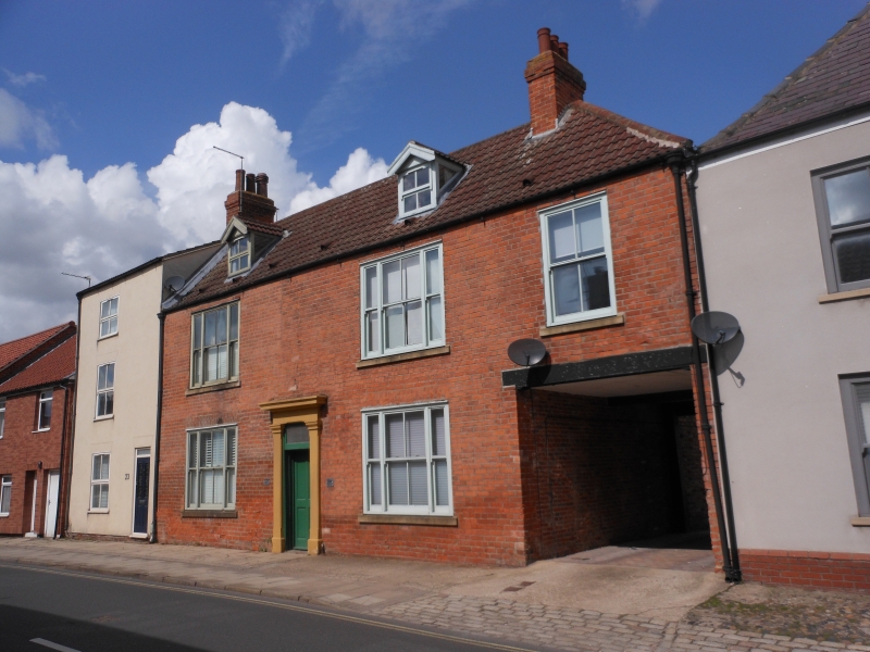
BEVERLEY BECKSIDE
TA 0439 (north side)
11/1
- No 25
(The Buck Public House)
GV II
C18, altered. 2 storeys in brick with hipped pantile roof. Gabled dormers.
3 modern windows over 2. Doorway with plain pilasters, entablature and cornice.
Carriage doorway.
Listing NGR: TA0439139282
External links are from the relevant listing authority and, where applicable, Wikidata. Wikidata IDs may be related buildings as well as this specific building. If you want to add or update a link, you will need to do so by editing the Wikidata entry.


Other nearby listed buildings
