History in Structure

Three Barns to Bower House Farm

A Grade II Listed Building in New Mills, Derbyshire

More Photos »
Approximate Location Map
Large Map »

Coordinates

Latitude: 53.377 / 53°22'37"N

Longitude: -2.0026 / 2°0'9"W

OS Eastings: 399925

OS Northings: 386684

OS Grid: SJ999866

Mapcode National: GBR GYGD.74

Mapcode Global: WHBB5.6CNY

Plus Code: 9C5V9XGW+RX

Entry Name: Three Barns to Bower House Farm

Listing Date: 19 September 1977

Grade: II

Source: Historic England

Source ID: 1088129

English Heritage Legacy ID: 81869

ID on this website: 101088129

Location: Hidebank, High Peak, Derbyshire, SK22

County: Derbyshire

District: High Peak

Civil Parish: New Mills

Traditional County: Derbyshire

Lieutenancy Area (Ceremonial County): Derbyshire

Church of England Parish: New Mills St George

Church of England Diocese: Derby

Tagged with: Building Barn

Find accommodation in
Birch Vale

Description


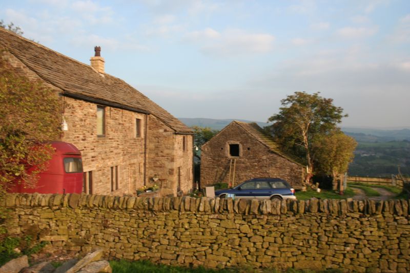
NEW MILLS WHITLE BANK ROAD
1.
5172
(North Side)
3 Barns to Bower House Farm
SJ 98 NE 2/103
II GV
2.
Widely-spaced range of 3 barns in coursed stone with stone slate roofs. C17 and C18.


Listing NGR: SJ9992586684

External Links

External links are from the relevant listing authority and, where applicable, Wikidata. Wikidata IDs may be related buildings as well as this specific building. If you want to add or update a link, you will need to do so by editing the Wikidata entry.

Recommended Books

Other nearby listed buildings

BritishListedBuildings.co.uk is an independent online resource and is not associated with any government department. All government data published here is used under licence. Please do not contact BritishListedBuildings.co.uk for any queries related to any individual listed building, planning permission related to listed buildings or the listing process itself.

British Listed Buildings is a Good Stuff website.