Approximate Location Map
Large Map »
Latitude: 51.1479 / 51°8'52"N
Longitude: -0.9788 / 0°58'43"W
OS Eastings: 471526
OS Northings: 139236
OS Grid: SU715392
Mapcode National: GBR B7Z.Z7H
Mapcode Global: VHDYB.ZDDV
Plus Code: 9C3X42XC+5F
Entry Name: 2 Busts in Public Gardens
Listing Date: 31 March 1977
Grade: II
Source: Historic England
Source ID: 1094144
English Heritage Legacy ID: 141891
ID on this website: 101094144
Location: The Public Gardens, Alton, East Hampshire, GU34
County: Hampshire
District: East Hampshire
Civil Parish: Alton
Built-Up Area: Alton
Traditional County: Hampshire
Lieutenancy Area (Ceremonial County): Hampshire
Church of England Parish: The Resurrection Alton
Church of England Diocese: Winchester
Tagged with: Building
WESTBROOKE ROAD
1.
5236
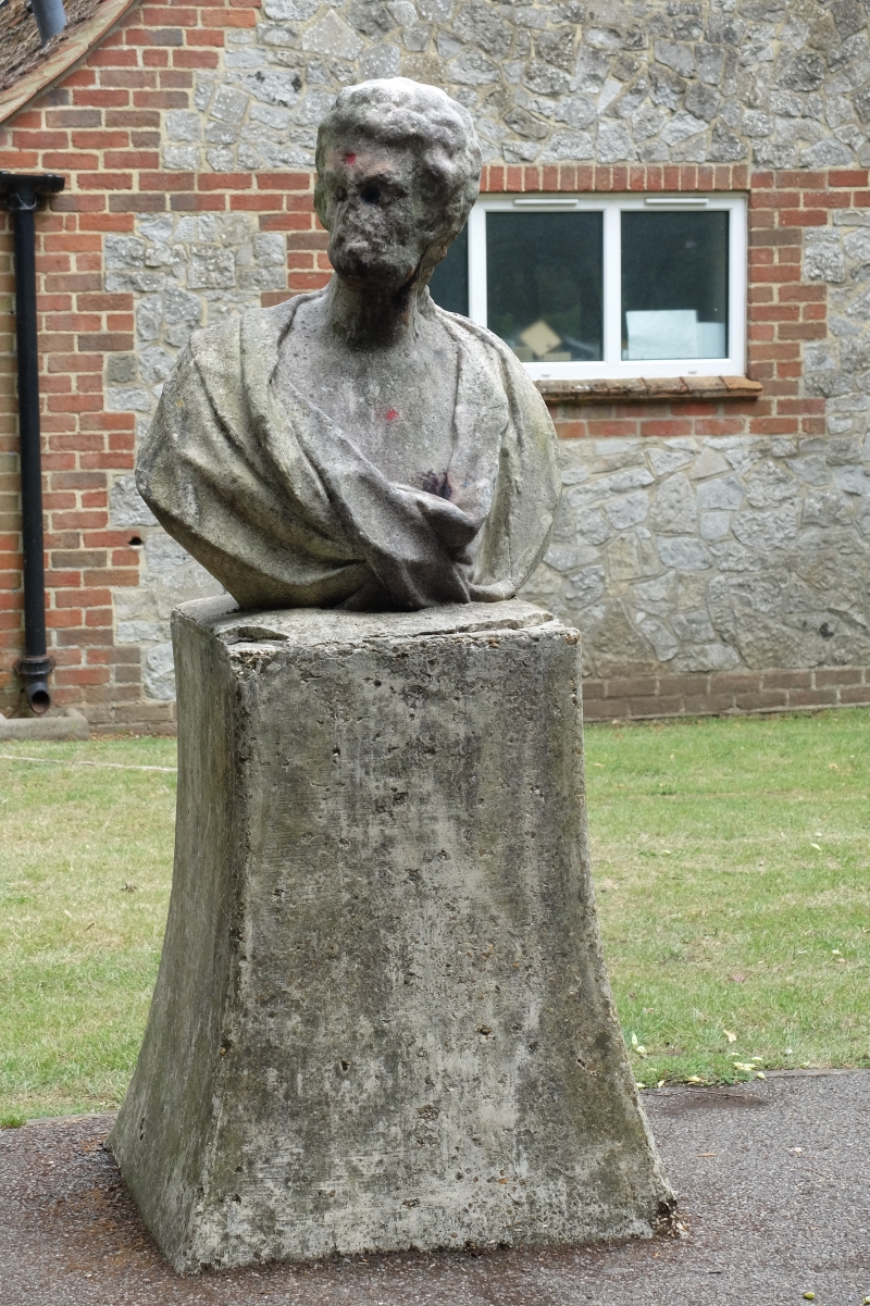
2 busts in Public Gardens
SU 7139 2/93
II
2.
Probably early C18. Unite marble, very weathered. Male and female head and shoulders
with Baroque draperies. Set on modern pedestals circa 1934/35.
Listing NGR: SU7092839639
External links are from the relevant listing authority and, where applicable, Wikidata. Wikidata IDs may be related buildings as well as this specific building. If you want to add or update a link, you will need to do so by editing the Wikidata entry.


Other nearby listed buildings
