Approximate Location Map
Large Map »
Latitude: 50.7194 / 50°43'9"N
Longitude: -3.2347 / 3°14'4"W
OS Eastings: 312935
OS Northings: 91810
OS Grid: SY129918
Mapcode National: GBR P8.V828
Mapcode Global: FRA 4735.PNK
Plus Code: 9C2RPQ98+Q4
Entry Name: Goosemoor Farmhouse
Listing Date: 12 November 1973
Grade: II
Source: Historic England
Source ID: 1097910
English Heritage Legacy ID: 87371
ID on this website: 101097910
Location: Sidbury, East Devon, EX10
County: Devon
District: East Devon
Civil Parish: Sidmouth
Traditional County: Devon
Lieutenancy Area (Ceremonial County): Devon
Church of England Parish: Sidbury with Sidford
Church of England Diocese: Exeter
Tagged with: Farmhouse Thatched cottage
GREENHEAD, SIDBURY
1.
1633
Goosemoor Farmhouse
SY 19 SW 12/223
II
2.
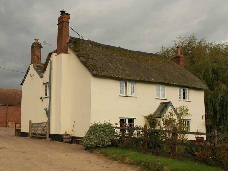
Reached by lane to north of Greenhead. Probably C17 or C18. 2 storey
plastered farmhouse with central gabled porch. Thatched roof. Gable
ends have stone external chimneys with offsets (now rendered) end brick
stacks. 2 and 3-light C19 wood casements.
Listing NGR: SY1293591810
External links are from the relevant listing authority and, where applicable, Wikidata. Wikidata IDs may be related buildings as well as this specific building. If you want to add or update a link, you will need to do so by editing the Wikidata entry.


Other nearby listed buildings
