Approximate Location Map
Large Map »
Latitude: 50.7695 / 50°46'10"N
Longitude: -3.0605 / 3°3'37"W
OS Eastings: 325314
OS Northings: 97194
OS Grid: SY253971
Mapcode National: GBR PF.CTGV
Mapcode Global: FRA 47G1.ZDZ
Plus Code: 9C2RQW9Q+RR
Entry Name: Woodend Farm House
Listing Date: 8 May 1967
Grade: II
Source: Historic England
Source ID: 1098394
English Heritage Legacy ID: 88162
ID on this website: 101098394
Location: Shute, East Devon, EX13
County: Devon
District: East Devon
Civil Parish: Shute
Traditional County: Devon
Lieutenancy Area (Ceremonial County): Devon
Church of England Parish: Shute St Michael
Church of England Diocese: Exeter
Tagged with: Farmhouse Thatched farmhouse
SY 29 NE SHUTE SHUTE VILLAGE
10/485
8.5.67 Woodend Farm House
II
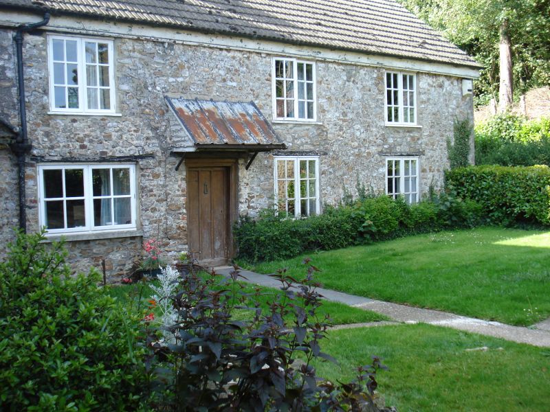
Farmhouse. Circa C17. Stone rubble house. Thatched roof, replaced with concrete
tiles, with gabled and hipped ends. Two storeys. L-shaped on plan. Three window
ranges. Casements with glazing bars. The north range has boarded door and hood.
Circular oven projecting in the angle. Brick ridge and end chimney stacks. Lean-to
on north side.
Listing NGR: SY2531497194
External links are from the relevant listing authority and, where applicable, Wikidata. Wikidata IDs may be related buildings as well as this specific building. If you want to add or update a link, you will need to do so by editing the Wikidata entry.


Other nearby listed buildings
