Approximate Location Map
Large Map »
Latitude: 50.7809 / 50°46'51"N
Longitude: -3.0679 / 3°4'4"W
OS Eastings: 324810
OS Northings: 98466
OS Grid: SY248984
Mapcode National: GBR PD.S57B
Mapcode Global: FRA 47G0.W1Z
Plus Code: 9C2RQWJJ+9V
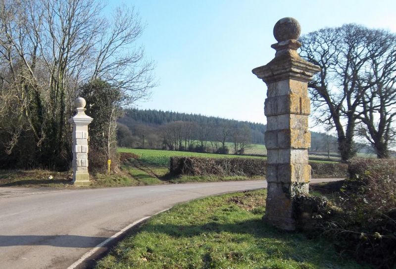
Entry Name: Shute Piers
Listing Date: 8 May 1967
Grade: II
Source: Historic England
Source ID: 1098433
English Heritage Legacy ID: 88149
ID on this website: 101098433
Location: East Devon, EX13
County: Devon
District: East Devon
Civil Parish: Shute
Traditional County: Devon
Lieutenancy Area (Ceremonial County): Devon
Church of England Parish: Shute St Michael
Church of England Diocese: Exeter
Tagged with: Building
SY 29 NW SHUTE DALWOOD ROAD
9/472
8.5.67 Shute Piers
II
Pair of former gate-piers. C18. Pair of gate piers on either side of road.
Rusticated ashlar on plan, with large moulded caps and ball finials. Graffiti
including date 1763.
Listing NGR: SY2481098466
External links are from the relevant listing authority and, where applicable, Wikidata. Wikidata IDs may be related buildings as well as this specific building. If you want to add or update a link, you will need to do so by editing the Wikidata entry.


Other nearby listed buildings
