Approximate Location Map
Large Map »
Latitude: 50.7161 / 50°42'57"N
Longitude: -3.5409 / 3°32'27"W
OS Eastings: 291313
OS Northings: 91850
OS Grid: SX913918
Mapcode National: GBR P0.QH6S
Mapcode Global: FRA 37G5.Y2G
Plus Code: 9C2RPF85+CJ
Entry Name: 8, Church Road
Listing Date: 29 January 1953
Grade: II
Source: Historic England
Source ID: 1104001
English Heritage Legacy ID: 88976
ID on this website: 101104001
Location: St Thomas, Exeter, Devon, EX2
County: Devon
District: Exeter
Electoral Ward/Division: St Thomas
Parish: Non Civil Parish
Built-Up Area: Exeter
Traditional County: Devon
Lieutenancy Area (Ceremonial County): Devon
Church of England Parish: Exeter St Thomas the Apostle
Church of England Diocese: Exeter
Tagged with: Building
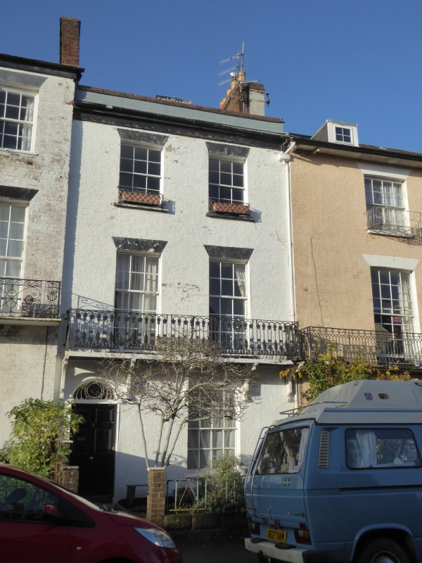
CHURCH ROAD
1.
1092
ST THOMAS
No 8
SX 9191 14/592 29.1.53
II GV
2.
Circa 1805-10. Red brick. Three storeys but slightly lower than Nos 6 and 7.
Two windows, sashes with glazing bars. Cast iron balcony on the first floor, of
different design to Nos 6 and 7, with wooden supports. Slate roof.
Nos 6 to 34 (consec) form a group.
Listing NGR: SX9131391850
External links are from the relevant listing authority and, where applicable, Wikidata. Wikidata IDs may be related buildings as well as this specific building. If you want to add or update a link, you will need to do so by editing the Wikidata entry.


Other nearby listed buildings
