Approximate Location Map
Large Map »
Latitude: 50.8316 / 50°49'53"N
Longitude: -4.0157 / 4°0'56"W
OS Eastings: 258145
OS Northings: 105500
OS Grid: SS581055
Mapcode National: GBR KS.WY8L
Mapcode Global: FRA 26GW.Z8J
Plus Code: 9C2QRXJM+JP
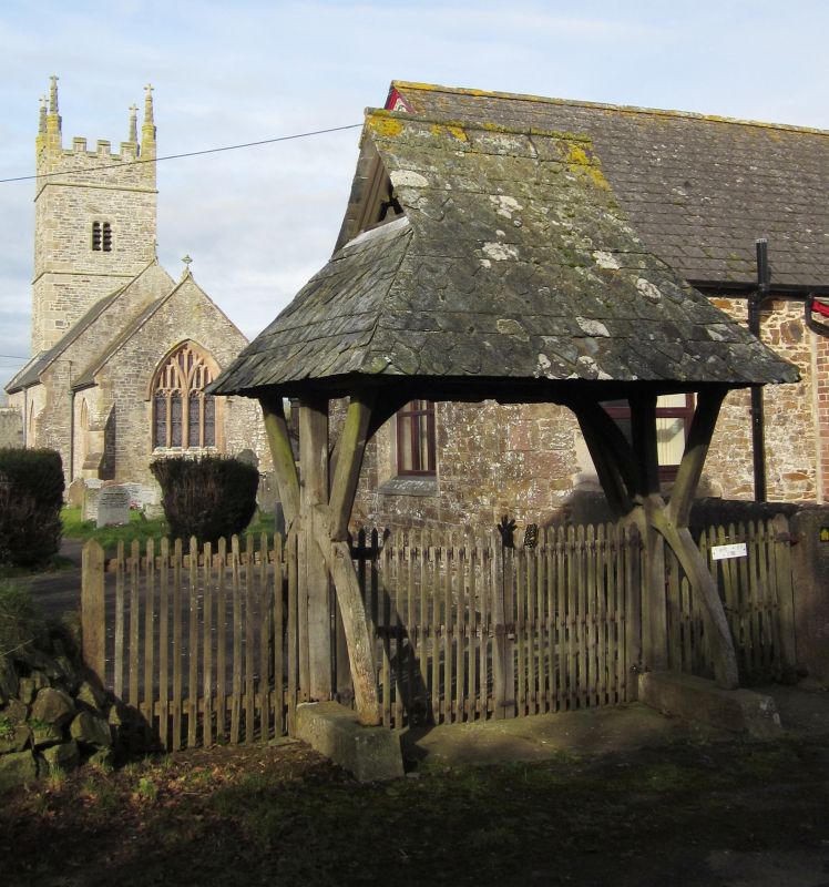
Entry Name: Lych Gate Approximately 35 Metres to South East of Church
Listing Date: 29 February 1988
Grade: II
Source: Historic England
Source ID: 1105189
English Heritage Legacy ID: 93316
ID on this website: 101105189
Location: All Saints' Church, Monkokehampton, West Devon, EX19
County: Devon
District: West Devon
Civil Parish: Monkokehampton
Traditional County: Devon
Lieutenancy Area (Ceremonial County): Devon
Church of England Parish: Monkokehampton All Saints
Church of England Diocese: Exeter
Tagged with: Lychgate
SS 50 NE
4/202
MONKOKEHAMPTON
MONKOKEHAMPTON
Lych gate approximately 35 metres to south east of Church
GV
II
Lych gate. Mid-late C19. Timber frame. Slate roof with gablets and alternating
plain and fish-scale courses. Roof is supported on end posts with curved bracing.
Listing NGR: SS5814505500
External links are from the relevant listing authority and, where applicable, Wikidata. Wikidata IDs may be related buildings as well as this specific building. If you want to add or update a link, you will need to do so by editing the Wikidata entry.


Other nearby listed buildings
