Approximate Location Map
Large Map »
Latitude: 50.9088 / 50°54'31"N
Longitude: -3.4002 / 3°24'0"W
OS Eastings: 301651
OS Northings: 113078
OS Grid: ST016130
Mapcode National: GBR LM.R4DC
Mapcode Global: FRA 36RP.Z0H
Plus Code: 9C2RWH5X+GW
Entry Name: Rock Bridge
Listing Date: 11 June 1986
Grade: II
Source: Historic England
Source ID: 1106646
English Heritage Legacy ID: 95389
ID on this website: 101106646
Location: Mid Devon, EX16
County: Devon
District: Mid Devon
Civil Parish: Halberton
Traditional County: Devon
Lieutenancy Area (Ceremonial County): Devon
Church of England Parish: Halberton
Church of England Diocese: Exeter
Tagged with: Bridge
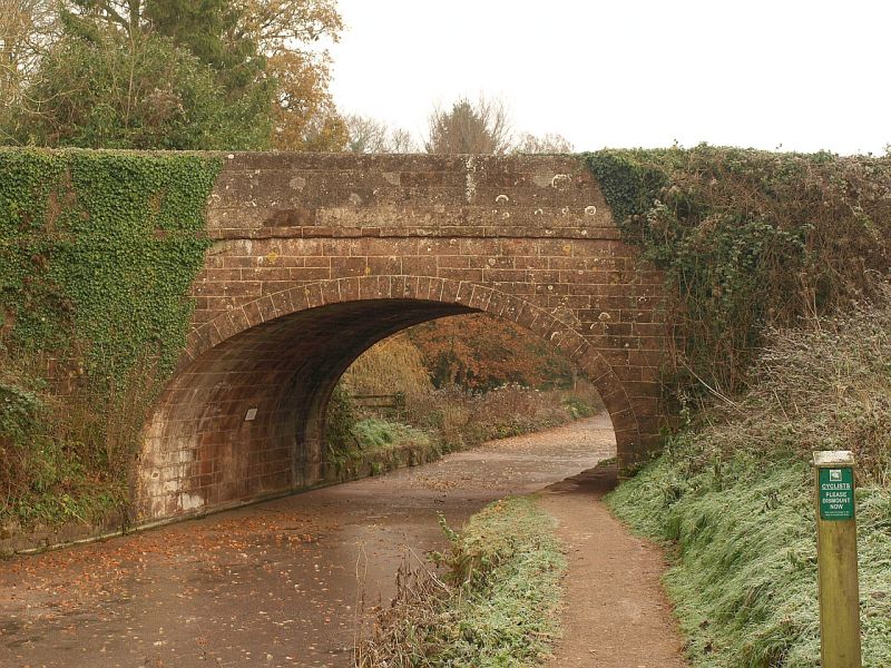
HALBERTON ROCK BRIDGE
ST 01 SW
2/203 Rock Bridge
-
GV II
Bridge carrying the A373 over the Grand Western Canal; the canal was established
under an Act of 1796 and the Halberton section completed in 1814. Conglomerate
ashlar; single elliptical arch, string course, parapet with round headed coping
stones. The bridge contributes to a group that includes Rock House (q.v.), set
above the canal at this point.
Listing NGR: ST0165113078
External links are from the relevant listing authority and, where applicable, Wikidata. Wikidata IDs may be related buildings as well as this specific building. If you want to add or update a link, you will need to do so by editing the Wikidata entry.


Other nearby listed buildings
