Approximate Location Map
Large Map »
Latitude: 50.9119 / 50°54'42"N
Longitude: -3.8686 / 3°52'6"W
OS Eastings: 268732
OS Northings: 114158
OS Grid: SS687141
Mapcode National: GBR KZ.QZRP
Mapcode Global: FRA 26SP.NP1
Plus Code: 9C2RW46J+QH
Entry Name: The Globe
Listing Date: 25 October 1988
Grade: II
Source: Historic England
Source ID: 1106686
English Heritage Legacy ID: 97286
ID on this website: 101106686
Location: Chulmleigh, North Devon, EX18
County: Devon
District: North Devon
Civil Parish: Chulmleigh
Built-Up Area: Chulmleigh
Traditional County: Devon
Lieutenancy Area (Ceremonial County): Devon
Church of England Parish: Chulmleigh St Mary Magdalene
Church of England Diocese: Exeter
Tagged with: Building
CHULMLEIGH THE SQUARE, Chulmleigh
SS 6814-6914
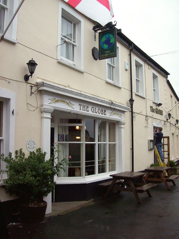
7/109 The Globe
GV II
Public house, formerly 2 adjoining houses, the left-hand house incorporating shop.
Circa 1880. Rendered stone rubble. Slate roofs with gable end brick stacks, that to
right with toothed capping.
Plan: Interior entirely altered in C20, but probably originally consisted of two
symmetrical 2 room and central passage plan houses, left-hand house ground floor
formerly used as shop.
Exterior: 2 storeys. Left-hand house has symmetrical 5 window range. All 2 paned
sashes with margin glazing bars. All windows have plain architraves with peaked
lintels. Large shop window incorporating doorway with plain moulded pilasters and
entablature. 3 large panes to shop window, canted at left end to recessed 4 panelled
door, the upper 2 panels glazed. French doors inserted in window opening at right
end and blocked window to right of shop window. House to right has symmetrical 3
window range, all 16 paned sashes 12 paned sashes to ground floor flanking central 16
paned sash inserted in blocked doorway. The right-hand house was the home of the
Literary and Scientific Society in the late C19, revived in 1925 as a men's club
which was closed in 1970.
Listing NGR: SS6873214158
External links are from the relevant listing authority and, where applicable, Wikidata. Wikidata IDs may be related buildings as well as this specific building. If you want to add or update a link, you will need to do so by editing the Wikidata entry.


Other nearby listed buildings
