Approximate Location Map
Large Map »
Latitude: 51.9109 / 51°54'39"N
Longitude: -0.6022 / 0°36'7"W
OS Eastings: 496248
OS Northings: 224518
OS Grid: SP962245
Mapcode National: GBR F3C.4LF
Mapcode Global: VHFRB.J70G
Plus Code: 9C3XW96X+94
Entry Name: The Old Windmill
Listing Date: 29 April 1952
Grade: II
Source: Historic England
Source ID: 1114728
English Heritage Legacy ID: 36065
ID on this website: 101114728
Location: Stanbridge, Central Bedfordshire, LU7
County: Central Bedfordshire
Civil Parish: Stanbridge
Built-Up Area: Stanbridge
Traditional County: Bedfordshire
Lieutenancy Area (Ceremonial County): Bedfordshire
Church of England Parish: Stanbridge
Church of England Diocese: St.Albans
Tagged with: Building
1.
5125 STANBRIDGE MILL ROAD
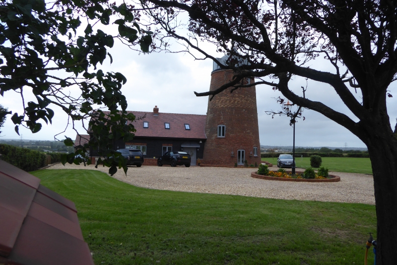
The Old Windmill
SP 9624 26/261 29.4.52
II
2.
Early C19. Four storey red brick tower mill. Cap and gear have been removed.
Now used as a private house.
Listing NGR: SP9624824518
External links are from the relevant listing authority and, where applicable, Wikidata. Wikidata IDs may be related buildings as well as this specific building. If you want to add or update a link, you will need to do so by editing the Wikidata entry.


Other nearby listed buildings
