Approximate Location Map
Large Map »
Latitude: 50.7997 / 50°47'58"N
Longitude: -3.1885 / 3°11'18"W
OS Eastings: 316336
OS Northings: 100688
OS Grid: ST163006
Mapcode National: GBR LX.YXQW
Mapcode Global: FRA 466Z.HLV
Plus Code: 9C2RQRX6+VH
Entry Name: 72, High Street
Listing Date: 21 March 1972
Grade: II
Source: Historic England
Source ID: 1116648
English Heritage Legacy ID: 442959
ID on this website: 101116648
Location: Honiton, East Devon, EX14
County: Devon
District: East Devon
Civil Parish: Honiton
Built-Up Area: Honiton
Traditional County: Devon
Lieutenancy Area (Ceremonial County): Devon
Church of England Parish: Honiton with Monkton
Church of England Diocese: Exeter
Tagged with: Building
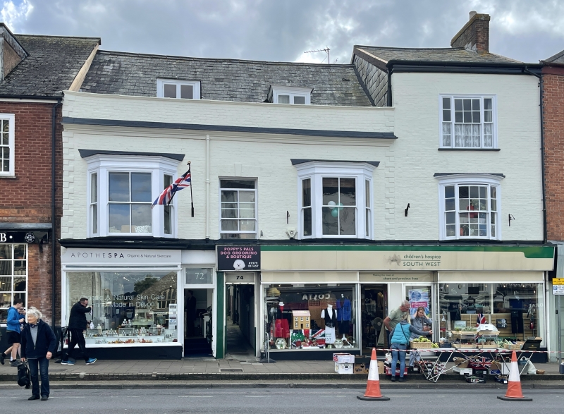
1. HIGH STREET
1228 (South Side)
No 72
ST 1600 1/67
II GV
2.
Early C18 altered, one composition, 2 storey and attic, 2 casement dormers,
brick colourwashed, rusticated quoins, parapet above cornice. Centre sash
window, at 1st floor, and 2 splay bays now with centre glazing bars only.
Early C19 altered wood shop front left, modernised shop front, right.
Nos 68 and 72 to 78 (even) form a group.
Listing NGR: ST1633600688
External links are from the relevant listing authority and, where applicable, Wikidata. Wikidata IDs may be related buildings as well as this specific building. If you want to add or update a link, you will need to do so by editing the Wikidata entry.


Other nearby listed buildings
