Approximate Location Map
Large Map »
Latitude: 51.4142 / 51°24'51"N
Longitude: -1.4354 / 1°26'7"W
OS Eastings: 439361
OS Northings: 168505
OS Grid: SU393685
Mapcode National: GBR 709.9WW
Mapcode Global: VHC1V.2QJ7
Plus Code: 9C3WCH77+MR
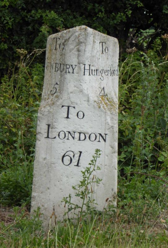
Entry Name: Milestone at Su 394 685
Listing Date: 21 June 1984
Grade: II
Source: Historic England
Source ID: 1117240
English Heritage Legacy ID: 39724
ID on this website: 101117240
Location: West Berkshire, RG20
County: West Berkshire
Civil Parish: Kintbury
Traditional County: Berkshire
Lieutenancy Area (Ceremonial County): Berkshire
Church of England Parish: Kintbury
Church of England Diocese: Oxford
Tagged with: Milestone
SU 36 NE KINTBURY BATH ROAD (north side)
12/6 Milestone at SU 394 685
II
Milestone. C18. Stone. Square on plan with upper corners cut away
to form triangular plan, weathered top. Inscribed "Newbury 5, Hungerford 4"
on upper faces and "London 61" on lower face.
Listing NGR: SU3936168505
External links are from the relevant listing authority and, where applicable, Wikidata. Wikidata IDs may be related buildings as well as this specific building. If you want to add or update a link, you will need to do so by editing the Wikidata entry.


Other nearby listed buildings
