Approximate Location Map
Large Map »
Latitude: 51.4006 / 51°24'2"N
Longitude: -1.4506 / 1°27'2"W
OS Eastings: 438313
OS Northings: 166987
OS Grid: SU383669
Mapcode National: GBR 70H.02X
Mapcode Global: VHC20.S2Z3
Plus Code: 9C3WCG2X+7P
Entry Name: Bronsden Tomb 17 Metres South of Tower
Listing Date: 21 June 1984
Grade: II
Source: Historic England
Source ID: 1117244
English Heritage Legacy ID: 39731
ID on this website: 101117244
Location: St Mary's Church, Kintbury, West Berkshire, RG17
County: West Berkshire
Civil Parish: Kintbury
Built-Up Area: Kintbury
Traditional County: Berkshire
Lieutenancy Area (Ceremonial County): Berkshire
Church of England Parish: Kintbury
Church of England Diocese: Oxford
Tagged with: Building
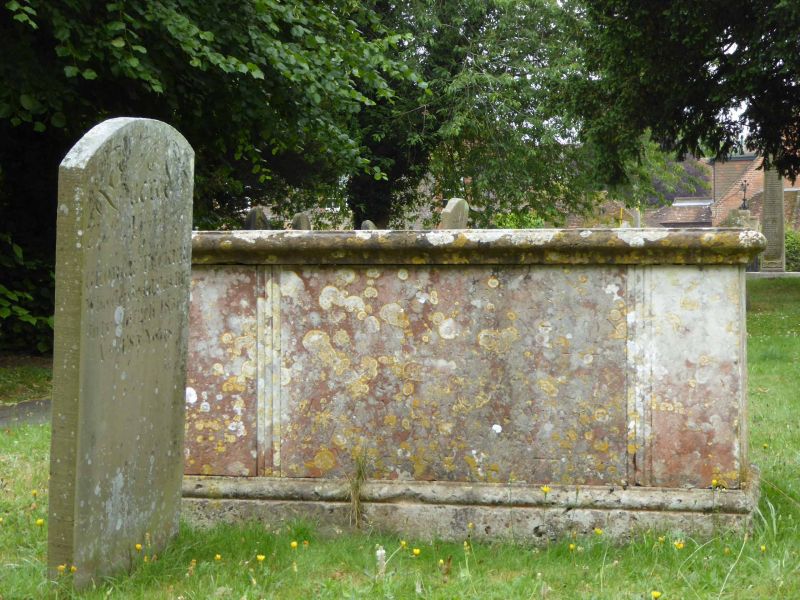
SU 36 NE KINTBURY CHURCH STREET
(St. Mary's Churchyard)
12/30 Bronsden Tomb. 17 metres
South of Tower
II
Tomb. C18. Stone. Chest with moulded top, plinth and reeded surround
to side panels. Inscribed to Jane Bronsden 1742.
Listing NGR: SU3831366987
External links are from the relevant listing authority and, where applicable, Wikidata. Wikidata IDs may be related buildings as well as this specific building. If you want to add or update a link, you will need to do so by editing the Wikidata entry.


Other nearby listed buildings
