Approximate Location Map
Large Map »
Latitude: 51.4118 / 51°24'42"N
Longitude: -0.8375 / 0°50'14"W
OS Eastings: 480948
OS Northings: 168723
OS Grid: SU809687
Mapcode National: GBR C6D.K2F
Mapcode Global: VHDX2.FSM3
Plus Code: 9C3XC567+P2
Entry Name: 10A, Shute End
Listing Date: 15 July 1987
Grade: II
Source: Historic England
Source ID: 1118010
English Heritage Legacy ID: 41760
ID on this website: 101118010
Location: Wokingham, Berkshire, RG40
County: Wokingham
Civil Parish: Wokingham
Built-Up Area: Wokingham
Traditional County: Berkshire
Lieutenancy Area (Ceremonial County): Berkshire
Church of England Parish: Wokingham St Paul
Church of England Diocese: Oxford
Tagged with: Building
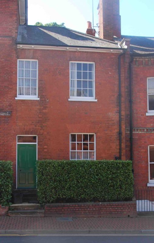
WOKINGHAM SHUTE END
SU 8068 NE
(South side)
17/15 No. 10A
G.V. II
Former service wing of No.10 (Shute End House) (listed separately 17/14).
c1830. Brick, hipped slate roof. 2 storeys. 2 bays. Sash windows with
glazing bars. 3 panes on first floor left hand with 4 panelled door and
plain fanlight under. 4 panes on right, both floors.
Listing NGR: SU8096068716
External links are from the relevant listing authority and, where applicable, Wikidata. Wikidata IDs may be related buildings as well as this specific building. If you want to add or update a link, you will need to do so by editing the Wikidata entry.


Other nearby listed buildings
