Approximate Location Map
Large Map »
Latitude: 54.5921 / 54°35'31"N
Longitude: -1.3167 / 1°18'59"W
OS Eastings: 444253
OS Northings: 522094
OS Grid: NZ442220
Mapcode National: GBR MH7B.RM
Mapcode Global: WHD6R.RT6Z
Plus Code: 9C6WHMRM+R8
Entry Name: Ray Tomb to South of Stagg Tomb
Listing Date: 21 June 1985
Grade: II
Source: Historic England
Source ID: 1121148
English Heritage Legacy ID: 59347
ID on this website: 101121148
Location: St Mary's Church, Norton, Stockton-on-Tees, North Yorkshire, TS20
County: Stockton-on-Tees
Electoral Ward/Division: Norton North
Parish: Non Civil Parish
Built-Up Area: Stockton-on-Tees
Traditional County: Durham
Lieutenancy Area (Ceremonial County): County Durham
Church of England Parish: Norton St Mary the Virgin
Church of England Diocese: Durham
Tagged with: Building
NZ 4422 SW NORTON THE GREEN
(West side)
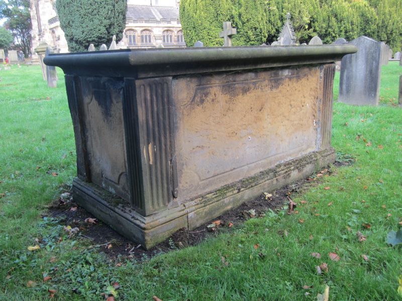
20/327 Ray tomb to south of
Stagg tomb.
II
Table tomb, burial 1806. Moulded slab on pannelled box with quadrant corners,
fluted angle columns.
Listing NGR: NZ4425322094
External links are from the relevant listing authority and, where applicable, Wikidata. Wikidata IDs may be related buildings as well as this specific building. If you want to add or update a link, you will need to do so by editing the Wikidata entry.


Other nearby listed buildings
