Approximate Location Map
Large Map »
Latitude: 51.5326 / 51°31'57"N
Longitude: -2.3575 / 2°21'27"W
OS Eastings: 375295
OS Northings: 181582
OS Grid: ST752815
Mapcode National: GBR 0NK.YK7
Mapcode Global: VH95V.3Q0Z
Plus Code: 9C3VGJMR+2X
Entry Name: 1, The Green, Badminton Road
Listing Date: 29 July 1983
Grade: II
Source: Historic England
Source ID: 1129239
English Heritage Legacy ID: 34052
ID on this website: 101129239
Location: South Gloucestershire, BS37
County: South Gloucestershire
Civil Parish: Sodbury
Built-Up Area: Old Sodbury
Traditional County: Gloucestershire
Lieutenancy Area (Ceremonial County): Gloucestershire
Church of England Parish: Old Sodbury St John the Baptist
Church of England Diocese: Gloucester
Tagged with: Building
ST 78 SE
2/5
SODBURY
OLD SODBURY
BADMINTON ROAD (north side)
No 1, The Green
GV
II
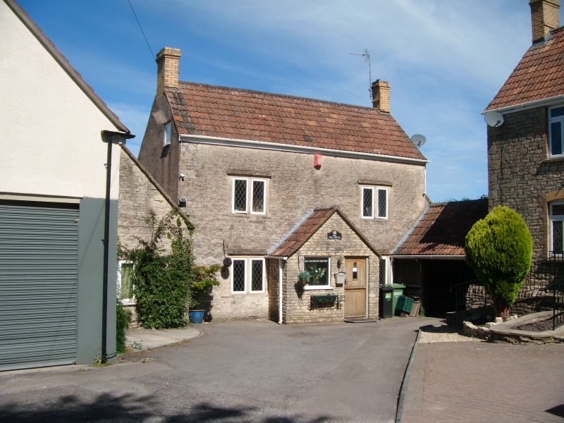
Late C17/early C18. Rubble. Double Roman tiled roof. Brick stacks. Two storeys.
Two windows, 2-light casements with stone mullions and flat dripmoulds above. Modern, projecting, gabled porch.
Listing NGR: ST7529581582
External links are from the relevant listing authority and, where applicable, Wikidata. Wikidata IDs may be related buildings as well as this specific building. If you want to add or update a link, you will need to do so by editing the Wikidata entry.


Other nearby listed buildings
