Approximate Location Map
Large Map »
Latitude: 53.1645 / 53°9'52"N
Longitude: -2.8068 / 2°48'24"W
OS Eastings: 346156
OS Northings: 363343
OS Grid: SJ461633
Mapcode National: GBR 7F.4NQB
Mapcode Global: WH88G.VQLD
Plus Code: 9C5V557V+Q7
Entry Name: Sundial in the Churchyard of St Peter
Listing Date: 30 January 1985
Grade: II
Source: Historic England
Source ID: 1130614
English Heritage Legacy ID: 55541
ID on this website: 101130614
Location: Cheshire West and Chester, Cheshire, CH3
County: Cheshire West and Chester
Civil Parish: Waverton
Traditional County: Cheshire
Lieutenancy Area (Ceremonial County): Cheshire
Church of England Parish: Waverton St Peter
Church of England Diocese: Chester
Tagged with: Sundial
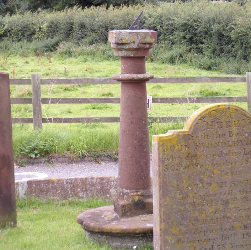
SJ 46 SE WAVERTON C.P. THE VILLAGE
(East Side)
2/29 Sundial in the
churchyard of St.Peter
GV II
Sundial: plate dated 1731. Red sandstone. Circular nosed base has
tall simple baluster on a square plinth set into it. Square capstone
carries good brass plate inscribed:-
Ion PRESCOT REC. R
I : E
S : A
CHURH WARDENS
1731
Lat 53° 16'
Listing NGR: SJ4615663343
External links are from the relevant listing authority and, where applicable, Wikidata. Wikidata IDs may be related buildings as well as this specific building. If you want to add or update a link, you will need to do so by editing the Wikidata entry.


Other nearby listed buildings
