Approximate Location Map
Large Map »
Latitude: 54.4037 / 54°24'13"N
Longitude: -1.7392 / 1°44'20"W
OS Eastings: 417030
OS Northings: 500948
OS Grid: NZ170009
Mapcode National: GBR JK9J.85
Mapcode Global: WHC6D.8K2W
Plus Code: 9C6WC736+F8
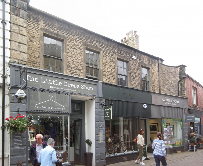
Entry Name: 13 and 13A, Finkle Street
Listing Date: 15 October 1973
Grade: II
Source: Historic England
Source ID: 1131232
English Heritage Legacy ID: 322945
ID on this website: 101131232
Location: Richmond, North Yorkshire, DL10
County: North Yorkshire
District: Richmondshire
Civil Parish: Richmond
Built-Up Area: Richmond
Traditional County: Yorkshire
Lieutenancy Area (Ceremonial County): North Yorkshire
Church of England Parish: Richmond with Holy Trinity with Hudswell
Church of England Diocese: Leeds
Tagged with: Building
1.
1549
NZ 1700 NW
1/348
FINKLE STREET
(West Side)
Nos 13 & 13A
II
GV
2.
Early C19. 2 storeys in small coursed rubble. Hung sash windows with
glazing bars in stone surrounds. Late C19 and modern shop fronts in stone
projecting ground floor.
Nos 11, 13 and 13A form a group
Listing NGR: NZ1703000948
External links are from the relevant listing authority and, where applicable, Wikidata. Wikidata IDs may be related buildings as well as this specific building. If you want to add or update a link, you will need to do so by editing the Wikidata entry.


Other nearby listed buildings
