Approximate Location Map
Large Map »
Latitude: 53.9613 / 53°57'40"N
Longitude: -2.0164 / 2°0'58"W
OS Eastings: 399022
OS Northings: 451689
OS Grid: SD990516
Mapcode National: GBR GQCM.8Q
Mapcode Global: WHB78.0P3K
Plus Code: 9C5VXX6M+GC
Entry Name: Barclays Bank
Listing Date: 2 March 1978
Grade: II
Source: Historic England
Source ID: 1131844
English Heritage Legacy ID: 323475
ID on this website: 101131844
Location: Skipton, North Yorkshire, BD23
County: North Yorkshire
District: Craven
Civil Parish: Skipton
Built-Up Area: Skipton
Traditional County: Yorkshire
Lieutenancy Area (Ceremonial County): North Yorkshire
Tagged with: Bank building
1.
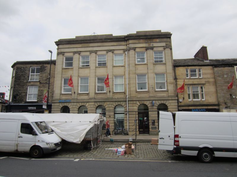
5336 HIGH STREET
(East Side)
No 49
(Barclay's Bank)
SD 9951 1/91
II GV
2.
Victorian. Ashlar, 3 storeys, 6 windows. Ground floor has round arched windows
and doorway. 1st and 2nd floors have sashes divided by giant Ionic pilasters.
The 2 right hand bays project slightly and contain the entrance. Top cornice.
Listing NGR: SD9902251689
External links are from the relevant listing authority and, where applicable, Wikidata. Wikidata IDs may be related buildings as well as this specific building. If you want to add or update a link, you will need to do so by editing the Wikidata entry.


Other nearby listed buildings
