Approximate Location Map
Large Map »
Latitude: 53.6468 / 53°38'48"N
Longitude: -1.762 / 1°45'43"W
OS Eastings: 415829
OS Northings: 416725
OS Grid: SE158167
Mapcode National: GBR JV48.BG
Mapcode Global: WHCB1.XL3N
Plus Code: 9C5WJ6WQ+P5
Entry Name: Priestroyd
Listing Date: 29 September 1978
Grade: II
Source: Historic England
Source ID: 1134376
English Heritage Legacy ID: 339611
ID on this website: 101134376
Location: Moldgreen, Kirklees, West Yorkshire, HD5
County: Kirklees
Electoral Ward/Division: Dalton
Parish: Non Civil Parish
Built-Up Area: Huddersfield
Traditional County: Yorkshire
Lieutenancy Area (Ceremonial County): West Yorkshire
Church of England Parish: Moldgreen Christ Church
Church of England Diocese: Leeds
Tagged with: Building
BROAD LANE
1.
5113
(West Side)
Mold Green
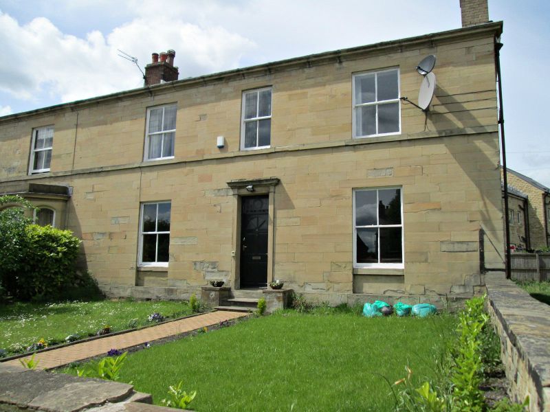
No 39 (Priestroyd)
and No 41
SE 1516 34/264
II
2.
Mid C19. Ashlar. Hipped stone slate roof. 2 storeys. Moulded eaves cornice.
Band. 6 ranges of sashes. No 39 has one late C19 canted bay on ground floor.
Doors with oblong fanlight, flanking Tuscan pilasters and cornice.
Listing NGR: SE1582916725
External links are from the relevant listing authority and, where applicable, Wikidata. Wikidata IDs may be related buildings as well as this specific building. If you want to add or update a link, you will need to do so by editing the Wikidata entry.


Other nearby listed buildings
