Approximate Location Map
Large Map »
Latitude: 53.6717 / 53°40'18"N
Longitude: -1.7861 / 1°47'9"W
OS Eastings: 414230
OS Northings: 419490
OS Grid: SE142194
Mapcode National: GBR HTZZ.3J
Mapcode Global: WHC9V.JZQ2
Plus Code: 9C5WM6C7+MH
Entry Name: 15, Lightridge Road
Listing Date: 29 September 1978
Grade: II
Source: Historic England
Source ID: 1134998
English Heritage Legacy ID: 340130
ID on this website: 101134998
Location: Netheroyd Hill, Kirklees, West Yorkshire, HD2
County: Kirklees
Electoral Ward/Division: Ashbrow
Parish: Non Civil Parish
Built-Up Area: Huddersfield
Traditional County: Yorkshire
Lieutenancy Area (Ceremonial County): West Yorkshire
Church of England Parish: St Francis Fixby and St Hilda Cowcliffe, Huddersfield
Church of England Diocese: Leeds
Tagged with: Building
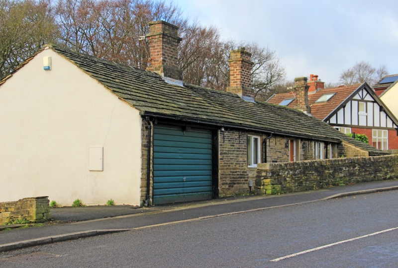
LIGHTRIDGE ROAD
1.
5113
No 15
SE 1419 17/803
II
2.
Early 019. Hammer-dressed stone. Pitched stone slate roof. One storey.
Altered front. Rear has three 2-light and two 3-light stone mullioned casements.
Listing NGR: SE1423019490
External links are from the relevant listing authority and, where applicable, Wikidata. Wikidata IDs may be related buildings as well as this specific building. If you want to add or update a link, you will need to do so by editing the Wikidata entry.


Other nearby listed buildings
