Approximate Location Map
Large Map »
Latitude: 53.9065 / 53°54'23"N
Longitude: -1.6889 / 1°41'20"W
OS Eastings: 420533
OS Northings: 445640
OS Grid: SE205456
Mapcode National: GBR JRN8.4C
Mapcode Global: WHC8Y.120J
Plus Code: 9C5WW846+JC
Entry Name: Boat Buildings
Listing Date: 8 July 1974
Grade: II
Source: Historic England
Source ID: 1135263
English Heritage Legacy ID: 341415
ID on this website: 101135263
Location: Otley, Leeds, West Yorkshire, LS21
County: Leeds
Civil Parish: Otley
Built-Up Area: Otley
Traditional County: Yorkshire
Lieutenancy Area (Ceremonial County): West Yorkshire
Church of England Parish: Otley All Saints
Church of England Diocese: Leeds
Tagged with: Building
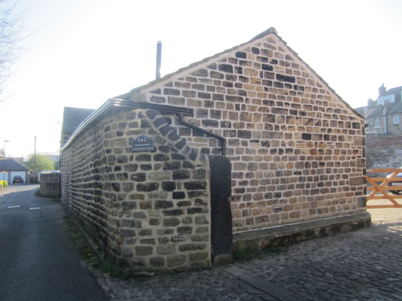
Courthouse Street
1.
1480
(South Side)
Boat Buildings
SE 2045 1/153
II
2.
Early Cl9. Barns and cowhouses round cobbled fold, included solely for
remains of C17 walling, part of which, to street, includes blocked doorway
initialled and dated 'J F l606'.
Listing NGR: SE2053345640
External links are from the relevant listing authority and, where applicable, Wikidata. Wikidata IDs may be related buildings as well as this specific building. If you want to add or update a link, you will need to do so by editing the Wikidata entry.


Other nearby listed buildings
