Approximate Location Map
Large Map »
Latitude: 51.3661 / 51°21'58"N
Longitude: -0.9655 / 0°57'55"W
OS Eastings: 472118
OS Northings: 163513
OS Grid: SU721635
Mapcode National: GBR C6T.8QH
Mapcode Global: VHDX6.6XYM
Plus Code: 9C3X928M+CR
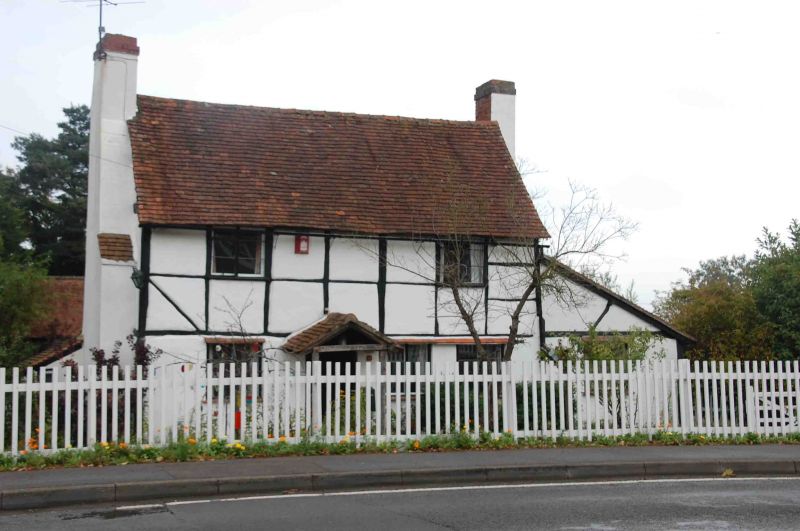
Entry Name: The Old Smithy
Listing Date: 14 February 1986
Grade: II
Source: Historic England
Source ID: 1135814
English Heritage Legacy ID: 41568
ID on this website: 101135814
Location: Riseley, Wokingham, Berkshire, RG7
County: Wokingham
Civil Parish: Swallowfield
Built-Up Area: Riseley
Traditional County: Berkshire
Lieutenancy Area (Ceremonial County): Berkshire
Church of England Parish: Swallowfield
Church of England Diocese: Oxford
Tagged with: Smithy
SWALLOWFIELD BASINGSTOKE ROAD
SU 76 SW
(East side) Riseley
11/4 The Old Smithy
G.V. II
Cottage. Early C17. Timber frame with painted brick infill, old tile
gabled roof. Rectangular plan of 3 framed bays with outshut at rear. 2
storeys. Flanking chimneys 2-light C20 casement windows. Entrance front:-
2 bays with C20 entrance door under small gabled roof slightly to left of
centre.
Listing NGR: SU7211863513
External links are from the relevant listing authority and, where applicable, Wikidata. Wikidata IDs may be related buildings as well as this specific building. If you want to add or update a link, you will need to do so by editing the Wikidata entry.


Other nearby listed buildings
