Approximate Location Map
Large Map »
Latitude: 51.5942 / 51°35'39"N
Longitude: -2.3998 / 2°23'59"W
OS Eastings: 372401
OS Northings: 188453
OS Grid: ST724884
Mapcode National: GBR JZ.BYW4
Mapcode Global: VH95M.C655
Plus Code: 9C3VHJV2+M3
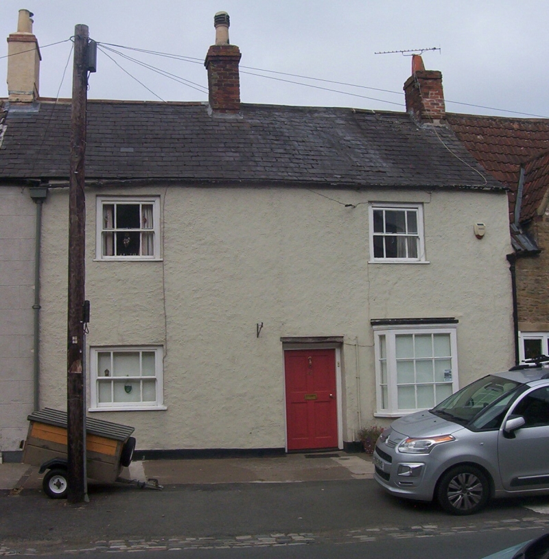
Entry Name: 48, High Street
Listing Date: 5 June 1984
Grade: II
Source: Historic England
Source ID: 1137308
English Heritage Legacy ID: 34822
ID on this website: 101137308
Location: Wickwar, South Gloucestershire, GL12
County: South Gloucestershire
Civil Parish: Wickwar
Built-Up Area: Wickwar
Traditional County: Gloucestershire
Lieutenancy Area (Ceremonial County): Gloucestershire
Church of England Parish: Wickwar Holy Trinity
Church of England Diocese: Gloucester
Tagged with: Building
ST 7288
9/198
WICKWAR
HIGH STREET (west side)
No. 48
G.V.
II
House, in the village street. C18. Rendered; slate roof; brick stacks.
2 storeys. 2 mid C19 sash windows; C20 bay on ground floor to right. Central
C20 door.
Listing NGR: ST7240188453
External links are from the relevant listing authority and, where applicable, Wikidata. Wikidata IDs may be related buildings as well as this specific building. If you want to add or update a link, you will need to do so by editing the Wikidata entry.


Other nearby listed buildings
