Approximate Location Map
Large Map »
Latitude: 54.5923 / 54°35'32"N
Longitude: -1.3161 / 1°18'58"W
OS Eastings: 444287
OS Northings: 522117
OS Grid: NZ442221
Mapcode National: GBR MH7B.VK
Mapcode Global: WHD6R.RTGV
Plus Code: 9C6WHMRM+WH
Entry Name: Table Tomb to South of Church
Listing Date: 21 June 1985
Grade: II
Source: Historic England
Source ID: 1140014
English Heritage Legacy ID: 59349
ID on this website: 101140014
Location: St Mary's Church, Norton, Stockton-on-Tees, North Yorkshire, TS20
County: Stockton-on-Tees
Electoral Ward/Division: Norton North
Parish: Non Civil Parish
Built-Up Area: Stockton-on-Tees
Traditional County: Durham
Lieutenancy Area (Ceremonial County): County Durham
Church of England Parish: Norton St Mary the Virgin
Church of England Diocese: Durham
Tagged with: Tomb
NZ 4422 SW NORTON THE GREEN
(West side)
20/310
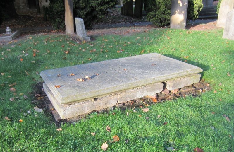
Table Tomb to South
of Church
GV II
To Jane Wilkinson who died 1811. Fluted corner piers; concrete sides; ends
slightly convex.
Listing NGR: NZ4428722117
External links are from the relevant listing authority and, where applicable, Wikidata. Wikidata IDs may be related buildings as well as this specific building. If you want to add or update a link, you will need to do so by editing the Wikidata entry.


Other nearby listed buildings
