Approximate Location Map
Large Map »
Latitude: 50.2557 / 50°15'20"N
Longitude: -5.175 / 5°10'29"W
OS Eastings: 173779
OS Northings: 44350
OS Grid: SW737443
Mapcode National: GBR Z5.ZZR5
Mapcode Global: FRA 081C.3QJ
Plus Code: 9C2P7R4G+72
Entry Name: Mine Chimney, Part of Killifreth Mine, at SW 737443 SW
Listing Date: 3 February 1986
Grade: II
Source: Historic England
Source ID: 1140926
English Heritage Legacy ID: 63179
ID on this website: 101140926
Location: Cornwall, TR4
County: Cornwall
Civil Parish: Chacewater
Traditional County: Cornwall
Lieutenancy Area (Ceremonial County): Cornwall
Church of England Parish: Chacewater
Church of England Diocese: Truro
Tagged with: Chimney
CHACEWATER
SW 74 SW
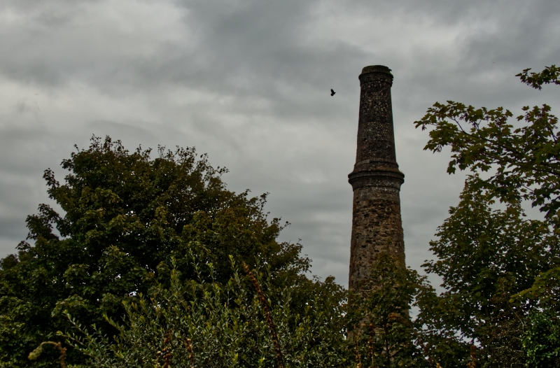
4/81 Mine chimney, part of Killifreth
- Mine, at SW 737443 SW
GV II
Mine chimney. Mid-late C19. Killas and granite with brick upper stage. Round on
plan. Tapered towards top with corbelled brick collar and cornice.
Killifreth Mine and Great Wheal Busy were being expanded, from 1865 and this chimney
is part of that development.
Listing NGR: SW7370044300
External links are from the relevant listing authority and, where applicable, Wikidata. Wikidata IDs may be related buildings as well as this specific building. If you want to add or update a link, you will need to do so by editing the Wikidata entry.


Other nearby listed buildings
