Approximate Location Map
Large Map »
Latitude: 50.117 / 50°7'1"N
Longitude: -5.5339 / 5°32'2"W
OS Eastings: 147464
OS Northings: 30081
OS Grid: SW474300
Mapcode National: GBR DXQC.MY2
Mapcode Global: VH12Z.1B85
Plus Code: 9C2P4F88+QC
Entry Name: 41-44, Chapel Street
Listing Date: 7 February 1974
Grade: II
Source: Historic England
Source ID: 1143158
English Heritage Legacy ID: 69462
ID on this website: 101143158
Location: Penzance, Cornwall, TR18
County: Cornwall
Civil Parish: Penzance
Built-Up Area: Penzance
Traditional County: Cornwall
Lieutenancy Area (Ceremonial County): Cornwall
Church of England Parish: Penzance St Mary the Virgin with St Paul
Church of England Diocese: Truro
Tagged with: Building
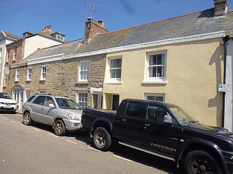
1.
1498 PENZANCE
CHAPEL STREET
(North East Side)
Nos 41 to 44 (consec)
SW 4730 5/30B
II GV
2.
C18 row with stuccoed fronts with low parapet, and steep slate roof behind.
2 storeys. 6 windows, sashes no glazing bars. 3 plain recessed doorways.
No 44 has small modern shop window.
All listed buildings on the North East Side of Chapel Street form a group.
Listing NGR: SW4746430081
External links are from the relevant listing authority and, where applicable, Wikidata. Wikidata IDs may be related buildings as well as this specific building. If you want to add or update a link, you will need to do so by editing the Wikidata entry.


Other nearby listed buildings
