Approximate Location Map
Large Map »
Latitude: 54.7636 / 54°45'48"N
Longitude: -2.6927 / 2°41'33"W
OS Eastings: 355526
OS Northings: 541180
OS Grid: NY555411
Mapcode National: GBR 9FMC.V5
Mapcode Global: WH80S.LJZJ
Plus Code: 9C6VQ874+CW
Entry Name: Mill House
Listing Date: 3 August 1984
Grade: II
Source: Historic England
Source ID: 1144813
English Heritage Legacy ID: 73480
ID on this website: 101144813
Location: Kirkoswald, Westmorland and Furness, Cumbria, CA10
County: Cumbria
District: Eden
Civil Parish: Kirkoswald
Traditional County: Cumberland
Lieutenancy Area (Ceremonial County): Cumbria
Church of England Parish: Kirkoswald St Oswald
Church of England Diocese: Carlisle
Tagged with: House
NY 55525 41185 KIRKOSWALD KIRKOSWALD
NY 55 41
12/54
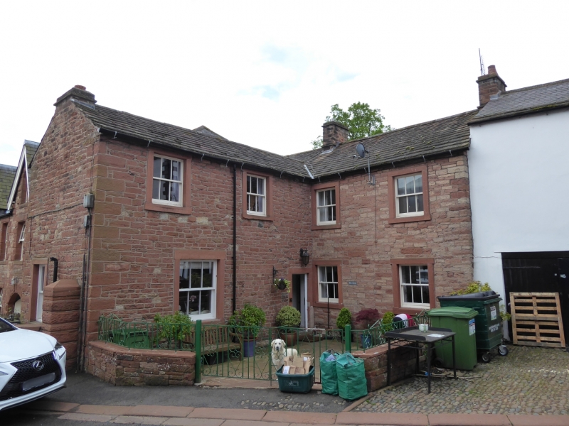
Mill House
II
House, probably originally the miller's house for the adjoining mill. Early
C19. Coursed red sandstone rubble walls, sandstone slate roof, end stone
chimney stacks. 2 storeys, 4 bays in L-shape. C20 door in plain painted stone
surround. 3-pane sash windows in plain painted stone surrounds.
Listing NGR: NY5552641180
External links are from the relevant listing authority and, where applicable, Wikidata. Wikidata IDs may be related buildings as well as this specific building. If you want to add or update a link, you will need to do so by editing the Wikidata entry.


Other nearby listed buildings
