Approximate Location Map
Large Map »
Latitude: 54.1 / 54°5'59"N
Longitude: -0.9304 / 0°55'49"W
OS Eastings: 470040
OS Northings: 467650
OS Grid: SE700676
Mapcode National: GBR PPY1.C0
Mapcode Global: WHFBL.P64Q
Plus Code: 9C6X33X9+XR
Entry Name: Chapel Farmhouse
Listing Date: 15 July 1985
Grade: II
Source: Historic England
Source ID: 1149625
English Heritage Legacy ID: 329500
ID on this website: 101149625
Location: Bulmer, North Yorkshire, YO60
County: North Yorkshire
District: Ryedale
Civil Parish: Bulmer
Traditional County: Yorkshire
Lieutenancy Area (Ceremonial County): North Yorkshire
Church of England Parish: Bulmer St Martin
Church of England Diocese: York
Tagged with: Farmhouse
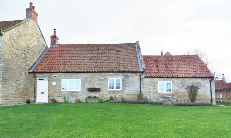
SE 76 NW BULMER MAIN STREET
(south side)
4/10 Chapel Farmhouse
GV II
House. Mid/late C18. Coursed limestone rubble, pantile roof. 2-cell end
lobby entry with outshut to rear and barn to right. Single storey. Board
door beneath divided overlight. Two C20 casements to right. Roof line
drops over barn. Swept roof, gable coping, left end stack.
Listing NGR: SE7004067650
External links are from the relevant listing authority and, where applicable, Wikidata. Wikidata IDs may be related buildings as well as this specific building. If you want to add or update a link, you will need to do so by editing the Wikidata entry.


Other nearby listed buildings
