Approximate Location Map
Large Map »
Latitude: 54.0934 / 54°5'36"N
Longitude: -1.3837 / 1°23'1"W
OS Eastings: 440403
OS Northings: 466564
OS Grid: SE404665
Mapcode National: GBR LPS3.6D
Mapcode Global: WHD97.QC8S
Plus Code: 9C6W3JV8+9G
Entry Name: The Firs
Listing Date: 19 December 1984
Grade: II
Source: Historic England
Source ID: 1150099
English Heritage Legacy ID: 330306
ID on this website: 101150099
Location: Aldborough, North Yorkshire, YO51
County: North Yorkshire
District: Harrogate
Civil Parish: Boroughbridge
Traditional County: Yorkshire
Lieutenancy Area (Ceremonial County): North Yorkshire
Tagged with: Architectural structure
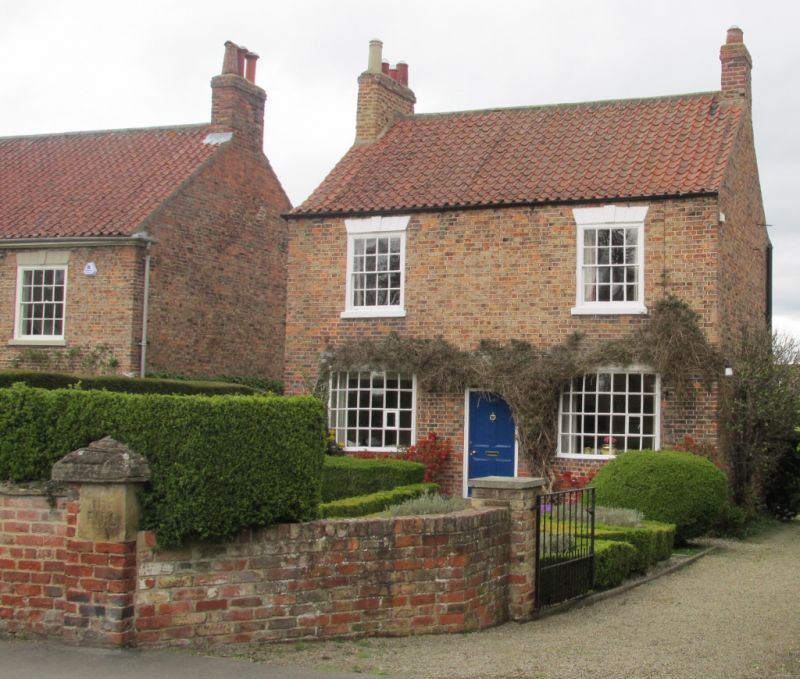
SE 4066 BOROUGHBRIDGE LOW ROAD, ALDBOROUGH
6/41 (north side)
The Firs
GV
II
House. Early C19. Pale brown brick. Pantile roof with end chimneys. Central
entrance with 4-panel door and oblong fanlight. Modern bow windows to either side.
16-pane sash windows with channelled stucco heads and plain cills. Primarily listed
for group value with Laurel House and Aldborough Lodge.
Listing NGR: SE4040366564
External links are from the relevant listing authority and, where applicable, Wikidata. Wikidata IDs may be related buildings as well as this specific building. If you want to add or update a link, you will need to do so by editing the Wikidata entry.


Other nearby listed buildings
