Approximate Location Map
Large Map »
Latitude: 54.0925 / 54°5'33"N
Longitude: -1.3808 / 1°22'50"W
OS Eastings: 440596
OS Northings: 466468
OS Grid: SE405664
Mapcode National: GBR LPS3.VP
Mapcode Global: WHD97.RDNG
Plus Code: 9C6W3JV9+2M
Entry Name: Sutton Farmhouse
Listing Date: 19 December 1984
Grade: II
Source: Historic England
Source ID: 1150101
English Heritage Legacy ID: 330311
ID on this website: 101150101
Location: Aldborough, North Yorkshire, YO51
County: North Yorkshire
District: Harrogate
Civil Parish: Boroughbridge
Traditional County: Yorkshire
Lieutenancy Area (Ceremonial County): North Yorkshire
Tagged with: Farmhouse
SE 4066 BOROUGHBRIDGE LOW ROAD, ALDBOROUGH
6/46 (north side)
Sutton Farmhouse
GV
II
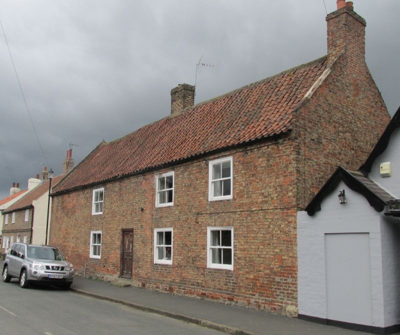
Farmhouse. C18. Pinkish-brown local brick. Stepped eaves. Plinth. Swept pantile
roof, continuous over outshot at rear. Raised brick verges. Off-centre ridge
chimney. 2 storeys. 3 irregular bays. Panelled door. Squat sash window in flush
wood architraves. Gauged flat brick arched to lower windows.
Listing NGR: SE4061066509
External links are from the relevant listing authority and, where applicable, Wikidata. Wikidata IDs may be related buildings as well as this specific building. If you want to add or update a link, you will need to do so by editing the Wikidata entry.


Other nearby listed buildings
