Approximate Location Map
Large Map »
Latitude: 50.542 / 50°32'31"N
Longitude: -4.3962 / 4°23'46"W
OS Eastings: 230310
OS Northings: 74099
OS Grid: SX303740
Mapcode National: GBR NJ.HBLQ
Mapcode Global: FRA 17PM.M4Q
Plus Code: 9C2QGJR3+QG
Entry Name: Guidestone at SX 302 740
Listing Date: 5 November 1987
Grade: II
Source: Historic England
Source ID: 1159047
English Heritage Legacy ID: 62148
ID on this website: 101159047
Location: Rillaton, Cornwall, PL17
County: Cornwall
Civil Parish: Linkinhorne
Traditional County: Cornwall
Lieutenancy Area (Ceremonial County): Cornwall
Church of England Parish: Linkinhorne
Church of England Diocese: Truro
Tagged with: Milestone
LINKINHORNE
SX 37 SW
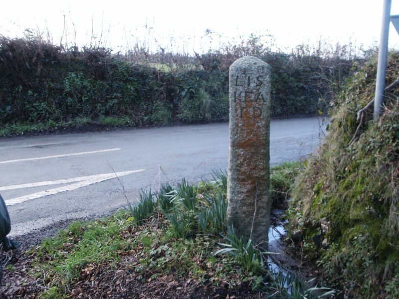
7/9 Guidestone at SX 302 740
-
II
Guidestone. Early C19. Granite monolith about one metre and 50 centimetres
high,with rounded head. Carved painted lettering in upper case, sanserif, to each of the four sides: REDGATE, LISKEARD, CAMELFORDE, and LAUNCESTON.
Listing NGR: SX3031074099
External links are from the relevant listing authority and, where applicable, Wikidata. Wikidata IDs may be related buildings as well as this specific building. If you want to add or update a link, you will need to do so by editing the Wikidata entry.


Other nearby listed buildings
