Approximate Location Map
Large Map »
Latitude: 53.8383 / 53°50'17"N
Longitude: -0.4262 / 0°25'34"W
OS Eastings: 503655
OS Northings: 439148
OS Grid: TA036391
Mapcode National: GBR TSG1.JV
Mapcode Global: WHGF4.FS8D
Plus Code: 9C5XRHQF+8G
Entry Name: 10, Keldgate
Listing Date: 30 June 1987
Grade: II
Source: Historic England
Source ID: 1161340
English Heritage Legacy ID: 167216
ID on this website: 101161340
Location: Beverley, East Riding of Yorkshire, HU17
County: East Riding of Yorkshire
Civil Parish: Beverley
Built-Up Area: Beverley
Traditional County: Yorkshire
Lieutenancy Area (Ceremonial County): East Riding of Yorkshire
Church of England Parish: Beverley Minster St John and St Martin
Church of England Diocese: York
Tagged with: Building
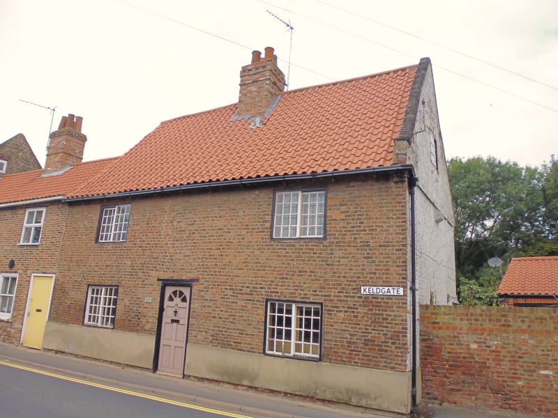
TA 0339 BEVERLEY KELDGATE
(north side)
10/116 No 10
GV II
Mid C18. 2 storeys in brick with modern tile roof with centre stack, cogged
brick eaves cornice. Central lobby entry plan. 2 windows, sliding sashes with
glazing bars, on both floors. Door of 6 fielded carved panels, wood lintel.
Listing NGR: TA0365539148
External links are from the relevant listing authority and, where applicable, Wikidata. Wikidata IDs may be related buildings as well as this specific building. If you want to add or update a link, you will need to do so by editing the Wikidata entry.


Other nearby listed buildings
