Approximate Location Map
Large Map »
Latitude: 52.5722 / 52°34'20"N
Longitude: -0.2397 / 0°14'22"W
OS Eastings: 519393
OS Northings: 298612
OS Grid: TL193986
Mapcode National: GBR HZQ.L7C
Mapcode Global: WHHNK.9L3X
Plus Code: 9C4XHQC6+V4
Entry Name: Well in the Great Cloister
Listing Date: 7 May 1973
Grade: I
Source: Historic England
Source ID: 1161668
English Heritage Legacy ID: 49668
ID on this website: 101161668
Location: St Peter's Cathedral, Peterborough, Cambridgeshire, PE1
County: City of Peterborough
Electoral Ward/Division: Central
Parish: Non Civil Parish
Built-Up Area: Peterborough
Traditional County: Northamptonshire
Lieutenancy Area (Ceremonial County): Cambridgeshire
Tagged with: Well
PETERBOROUGH
1.
1500
PRECINCTS
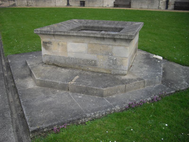
Well in the Great Cloister
TL 1998 NW 1/373
1 GV
2.
Modern cap, but contains Norman walling and steps.
Garden Walls and Gates, Former Outbuilding, Wal to North & Mounting block all to
and including Laurel Court, Hostry Passage & Little Dorter, Great Cloister & Well form
a group.
Listing NGR: TL1939398612
External links are from the relevant listing authority and, where applicable, Wikidata. Wikidata IDs may be related buildings as well as this specific building. If you want to add or update a link, you will need to do so by editing the Wikidata entry.


Other nearby listed buildings
