Approximate Location Map
Large Map »
Latitude: 53.784 / 53°47'2"N
Longitude: -1.0709 / 1°4'15"W
OS Eastings: 461316
OS Northings: 432361
OS Grid: SE613323
Mapcode National: GBR NSYP.Y9
Mapcode Global: WHFD2.J48Z
Plus Code: 9C5WQWMH+HJ
Entry Name: 24-28, Gowthorpe
Listing Date: 14 November 1980
Grade: II
Source: Historic England
Source ID: 1167236
English Heritage Legacy ID: 325763
ID on this website: 101167236
Location: Selby, North Yorkshire, YO8
County: North Yorkshire
District: Selby
Civil Parish: Selby
Built-Up Area: Selby
Traditional County: Yorkshire
Lieutenancy Area (Ceremonial County): North Yorkshire
Church of England Parish: Selby St Mary and St Germain
Church of England Diocese: York
Tagged with: Building
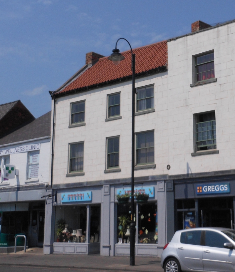
GOWTHORPE
1. (north side)
5342 ------------
Nos 24 to 28 (even)
SE 6132 SW 4/76
II
2.
C18 or early C19. Stucco. Pitched pantile roof. Coped gable. Three storeys.
Brick modillion eaves cornice. Three bays: sashes. Modern shop-front.
Listing NGR: SE6111032272
External links are from the relevant listing authority and, where applicable, Wikidata. Wikidata IDs may be related buildings as well as this specific building. If you want to add or update a link, you will need to do so by editing the Wikidata entry.


Other nearby listed buildings
